Area Overview for Santon Downham
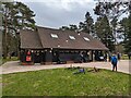
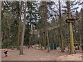
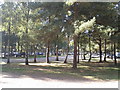
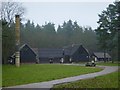
Photos of Santon Downham


Area Information
Living in Santon Downham offers a distinctly rural experience within the civil parish of Norfolk. You will find yourself on a property holding 15.9 km² of land, which defines the physical limits of this sleepy settlement. The location sits quietly within the broader English countryside, away from the noise and rush of major urban centres. Daily life here revolves around a slower pace, with access to local amenities dependent on travel to nearby towns. The area does not feature large-scale commercial hubs within its immediate boundaries, meaning your routine will likely involve time outside the parish for shopping or broader leisure activities. This environment appeals to those seeking a retreat from city living. You gain immediate access to open spaces and a sense of seclusion that is rare in more populated regions. The parish structure ensures local governance remains focused on community needs rather than complex urban planning issues. While the lack of extensive services might frustrate some, it creates a tight-knit atmosphere where neighbours know one another by name. You can enjoy the solitude of a large plot or the charm of a cottage without the stress of local congestion. Homes here reflect a lifestyle where the natural landscape takes precedence over modern urban sprawl. For buyers considering this location, the decision hinges on your need for isolation versus accessibility. The parish boundaries enclose a village that feels detached from the rapid changes happening elsewhere in the country. You will find that residents prioritise tranquility and space over immediate proximity to city centres. The 15.9 km² footprint suggests limited development potential, preserving the character you choose to inhabit.
- Area Type
- Parish
- Area Size
- 15.9 km²
- Population
- Not available
- Population Density
- Not available
Demographics
The community within Santon Downham reflects a mature population with a median age of 70 years. This demographic profile indicates that the village is a preferred retirement destination rather than a family hub. You will find predominantly older residents settling into homes designed for comfortable living in their twilight years. The age concentration suggests that schools near Santon Downham may not be the primary draw for new families looking to relocate. Parents considering this parish must weigh the quiet environment against the need for local educational infrastructure. Home ownership stands at a solid 58% of households. This figure reveals a stable tenure where long-term residents have rooted themselves in the area over many decades. Nearly two-thirds of you would find this area familiar and established, with a legacy of ownership rather than a fluctuating rental market. The remaining households likely consist of private landlords or those navigating the path to purchase within a tight property stock. Accommodation types and ethnic diversity data are not specified in the current records, but the ownership rate points toward a traditional housing stock. The household composition aligns with an older demographic, suggesting smaller family units or single-person households dominate the street scene. You can expect a conservative social fabric where traditions hold significant weight. This demographic reality shapes the local vibe, making it less dynamic for young professionals seeking a lively youth culture. Instead, you gain a community built on longevity and established neighbourly ties.
Household Size
Accommodation Type
Tenure
Ethnic Group
Religion
Household Composition
Age
Household Deprivation
NS-SEC
Explore more demographic insights in this area
Go to Demographics tabPlanning
Planning Constraints
- Flood RiskPremium
- Ramsar Wetland SitesPremium
- Area of Outstanding Natural BeautyPremium
- Protected Nature ReservePremium
- Protected WoodlandPremium
- Crime RiskPremium