Area Overview for Sandringham
Photos of Sandringham
Area Information
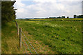
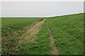
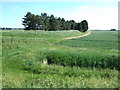
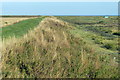
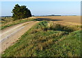
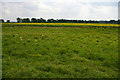
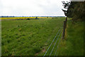
Sandringham operates as a civil parish covering an area of 41.3 km² within England. You are entering a community defined by its specific geographical constraints and its relationship with the surrounding countryside. The parish contains designated Areas of Outstanding Natural Beauty alongside protected nature reserves and Ramsar wetland sites. These designations create a landscape where planning is heavily influenced by environmental conservation. Daily life here revolves around proximity to these protected natural assets rather than urban density. The large size of the parish means infrastructure is spread thin across 41.3 km². You will find that the area prioritises maintaining open spaces over urban development. The character of Sandringham is shaped by this mix of conservation status and rural setting. Living in Sandringham requires an acceptance of these environmental boundaries. The parish does not offer the same density found in larger towns. Your experience of the area will be dictated by these geographical and planning realities. The mix of conservation areas defines the visual and functional identity of this locality.
- Area Type
- Parish
- Area Size
- 41.3 km²
- Population
- Not available
- Population Density
- Not available
Demographics
The population profile of Sandringham indicates a significantly older demographic. The median age in this parish stands at 70 years. This figure suggests a community dominated by retirees or long-term residents rather than young families or working-age professionals. The age data confirms that the neighbourhood has aged substantially over recent decades. Household composition largely reflects this older population structure. Approximately 54% of homes in Sandringham are owner-occupied. This high rate of ownership typically aligns with an older demographic where residents have achieved security of tenure. You will find minimal rental pressure compared to urban centres. The household statistics point towards stable, long-term living arrangements. Diversity data is not explicitly broken down in the available records for this specific parish. Despite the age profile, the area remains home to a settled resident base. The demographic makeup of Sandringham is distinctively senior compared to the national average.
Household Size
Accommodation Type
Tenure
Ethnic Group
Religion
Household Composition
Age
Household Deprivation
NS-SEC
Explore more demographic insights in this area
Go to Demographics tabPlanning
Planning Constraints
- Flood RiskPremium
- Ramsar Wetland SitesPremium
- Area of Outstanding Natural BeautyPremium
- Protected Nature ReservePremium
- Protected WoodlandPremium
- Crime RiskPremium