Area Overview for Sandridge
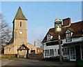
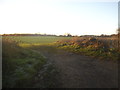
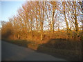
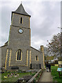
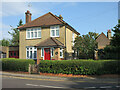
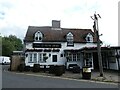
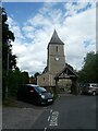
Photos of Sandridge

Area Information
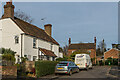
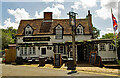
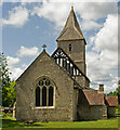
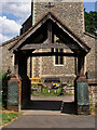
Sandridge is a compact built-up area in England, spanning 47.2 hectares. It is a place where older residents predominate, with a median age of 70, suggesting a community rooted in stability and familiarity. The area’s character is defined by its proximity to essential services, including five retail outlets such as Tesco St Albans and Morrisons Daily, which cater to daily needs. Rail connectivity is strong, with five nearby stations, including St Albans City Railway Station, offering easy access to surrounding towns and cities. Home ownership is high, at 74%, indicating a settled population. Safety is a notable feature, with a crime risk score of 83, reflecting below-average crime rates. For families, the presence of Sandridge School, a primary school with a good Ofsted rating, adds to the area’s appeal. Living here means a balance of convenience, safety, and a quiet, community-focused lifestyle.
- Area Type
- Built Up Area 250
- Area Size
- 47.2 hectares
- Population
- Not available
- Population Density
- Not available
Sandridge offers a mix of retail and transport options within easy reach. Five retail outlets, including Tesco St Albans and Morrisons Daily, provide convenience for shopping and daily essentials. The rail network, with stations such as St Albans City and St Albans Abbey, connects residents to broader regional hubs, enhancing mobility. While the area is compact, the proximity to these amenities ensures a lifestyle that balances local convenience with broader connectivity. The presence of a good primary school and low crime risk further contributes to a practical, community-oriented way of life.
Amenities
Schools
Sandridge is served by Sandridge School, a primary school with a good Ofsted rating. This provides families with a locally available option for younger children. The absence of secondary schools in the immediate vicinity means students may need to travel to nearby towns for further education. However, the good rating at Sandridge School suggests a focus on quality teaching and facilities. For parents, the presence of a well-regarded primary school is a significant factor in choosing the area. The school’s proximity to homes in Sandridge makes it a practical choice for families prioritising convenience.
| Rank | School | Type | Entry gender | Ages |
|---|
Explore more schools in this area
Go to Schools tabDemographics
Sandridge’s population is marked by an older demographic, with a median age of 70. This suggests a community where retirees and long-term residents form the majority. Home ownership is high at 74%, indicating a strong presence of owner-occupied properties. While the data does not specify household composition or accommodation types, the overall profile points to a stable, low-turnover population. The area’s demographic makeup does not include detailed breakdowns of ethnic groups or religious affiliations, but the overall sense is one of continuity and familiarity. The older age profile may influence local services and amenities, with a focus on accessibility and community support.
Household Size
Accommodation Type
Tenure
Ethnic Group
Religion
Household Composition
Age
Household Deprivation
NS-SEC
Explore more demographic insights in this area
Go to Demographics tabPlanning
Planning Constraints
- Crime RiskPremium