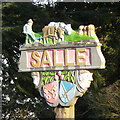
Area Overview for Salle
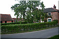
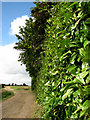
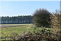
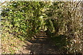
Photos of Salle


Area Information
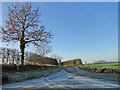
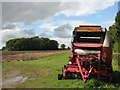
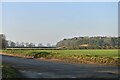
Salle is a civil parish covering an area of 8.2 km², situated in a settled locality where the pace of life reflects its small-scale geography. Living in Salle offers a specific type of regional existence defined by limited spatial boundaries and a quiet, established character. The parish caters to residents who seek a setting far removed from the intensity of major urban centres or industrial zones. This environment suits those who prioritise stability over rapid development or high-energy amenities. The physical size of the parish means that most aspects of daily life occur within a very contained radius, reducing travel times for essential errands and encouraging local interaction. You will find a community where the built environment has reached a point of maturity, suggesting that rapid, large-scale regeneration is unlikely in the near future. This stability appeals to individuals and families who value a predictable setting for their long-term residence rather than a location undergoing constant transformation.
- Area Type
- Parish
- Area Size
- 8.2 km²
- Population
- Not available
- Population Density
- Not available
Demographics
The community in Salle is defined by an exceptionally mature age profile, with a median age of 70 years. This statistic indicates that the parish is populated predominantly by older adults, many of whom have lived there for a significant period. The demographic makeup contrasts sharply with areas typical of new growth or university towns. Home ownership stands at 65 per cent, a figure that underscores the area's standing as an estate of retired homeowners rather than a rental market or one dominated by first-time buyers. This high level of ownership often correlates with stronger community cohesion, as residents have remained in their current addresses for decades. Accommodation types and household composition reflect this age distribution, with properties likely sized for single occupants or couples rather than large families. While data on ethnicity and religion is not specified, the narrow age range suggests a homogeneous population driven by retirement patterns. If you are considering homes in Salle, you are entering a neighbourhood where residents have likely settled permanently rather than transiently.
Household Size
Accommodation Type
Tenure
Ethnic Group
Religion
Household Composition
Age
Household Deprivation
NS-SEC
Explore more demographic insights in this area
Go to Demographics tabPlanning
Planning Constraints
- Flood RiskLocked
- Ramsar Wetland SitesLocked
- Area of Outstanding Natural BeautyLocked
- Protected Nature ReserveLocked
- Protected WoodlandLocked
- Crime RiskLocked