Area Overview for Rushmere St Andrew
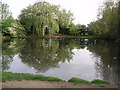
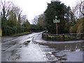
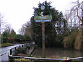
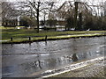
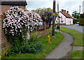
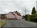
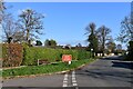
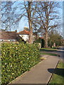
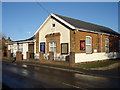
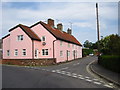
Photos of Rushmere St Andrew


Area Information
Rushmere St Andrew is a compact built-up area in England, spanning 42.2 hectares. Its small size contributes to a tightly knit community, where daily life is shaped by proximity to essential services. With a median age of 70, the area reflects a demographic skew towards older residents, though the population remains active and engaged. The high home ownership rate of 88% suggests a stable, long-term resident base. Living here offers a blend of practicality and quietude, with nearby rail links and retail options within easy reach. The presence of five rail stations, including Derby Road Railway Station, ensures connectivity to surrounding regions. For those prioritising convenience, the area’s proximity to shops such as East of England Co-operative Co and M&S Ipswich NHS Hospital SF adds to its appeal. Rushmere St Andrew is not a place for those seeking a fast-paced lifestyle, but it offers a measured, accessible existence suited to those valuing stability and ease of access to amenities.
- Area Type
- Built Up Area 250
- Area Size
- 42.2 hectares
- Population
- Not available
- Population Density
- Not available
Rushmere St Andrew offers a range of amenities within practical reach, enhancing daily life for residents. The area is served by five retail outlets, including the East of England Co-operative Co and M&S Ipswich NHS Hospital SF, ensuring access to essential shopping and healthcare services. For transportation, five rail stations—such as Entrance2 and Entrance3—provide straightforward connections to nearby towns and cities. While the data does not detail parks or leisure facilities, the proximity to retail and rail suggests a focus on functional living over expansive recreational spaces. The presence of NHS services and retail options contributes to a self-contained lifestyle, where residents can meet most needs without traveling far. This balance of practicality and accessibility defines the area’s character, appealing to those prioritising convenience over sprawling amenities.
Amenities
Schools
| Rank | School | Type | Entry gender | Ages |
|---|
Explore more schools in this area
Go to Schools tabDemographics
The population of Rushmere St Andrew has a median age of 70, indicating a community predominantly composed of older adults. This age profile suggests a demographic that may prioritise comfort, accessibility, and proximity to healthcare services. Home ownership is exceptionally high at 88%, reflecting a strong presence of long-term residents who have established roots in the area. The data does not specify household types or ethnic diversity, but the overall figures imply a relatively uniform demographic structure. With no explicit information on deprivation or socioeconomic variation, it is reasonable to infer that the area’s quality of life is shaped by its mature population and high ownership rates. The absence of detailed diversity metrics means the community’s cultural or social composition remains less defined in the provided data.
Household Size
Accommodation Type
Tenure
Ethnic Group
Religion
Household Composition
Age
Household Deprivation
NS-SEC
Explore more demographic insights in this area
Go to Demographics tabPlanning
Planning Constraints
- Crime RiskPremium