Area Overview for Rumburgh
Photos of Rumburgh
Area Information
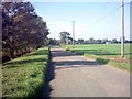
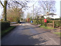
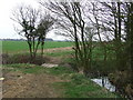
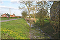
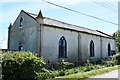
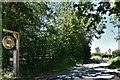
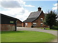
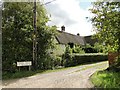
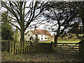
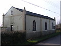
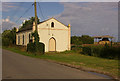
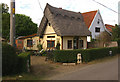
Rumburgh is a civil parish located in East Suffolk, West of the market town of Halesworth. The parish covers a total area of 6.2 square kilometres, providing a compact living environment for those seeking village life without major urban sprawl. You will find the settlement sits approximately 3.5 miles north-west of Halesworth, placing it firmly within the Waveney District. The community possesses deep historical roots, established by a Benedictine Priory founded in 1064 and dedicated to St. Michael and St. Felix. Despite its small footprint, the parish holds significant heritage, including the surviving church of St. Michael and a rectangular moat surrounding Abbey Farm and the churchyard. Today, living in Rumburgh means accessing a location where history remains visible in the landscape, from the medieval drawbridge traces in the churchyard to the agricultural land management that characterised the medieval economy. The area offers a quiet existence for residents who prefer a setting defined by local landmarks rather than modern commercial developments. The most distinctive feature of Rumburgh is its separation from Halesworth, which currently sits 3.5 miles south-east. This distance defines the daily rhythm of life for residents, who often rely on the nearby market town for broader commercial services. The parish coordinates at 52.38°N, 1.46°E locate it within a region known for its rural character. While the village lacks the density of larger towns, it retains a defined identity through its monastic past. The absence of modern planning constraints such as Areas of Outstanding Natural Beauty or protected woodlands suggests that some change to the built environment may occur. However, the core character remains anchored by the priory's legacy, making this a traditional Suffolk destination. For you, the potential buyer, Rumburgh represents a specific type of English village market where history outweighs contemporary development.
- Area Type
- Parish
- Area Size
- 6.2 km²
- Population
- Not available
- Population Density
- Not available
Demographics
The community profile of Rumburgh points to a notably mature population. The median age sits at 70 years, reflecting a demographic where older residents form the core of the community. You are likely to encounter long-term locals rather than transient families, as the age distribution heavily skews towards this older bracket. A 75% home ownership rate confirms that the majority of residents have purchased their properties rather than renting them. This high level of equity among owners suggests that many households have been established in the area for significant periods, contributing to a stable social fabric. The household composition data indicates a total snapshot without specific breakdowns for family sizes, which aligns with the older average age. Accommodation type data covers the total stock but does not specify the ratio of detached properties to terraced housing. The low ownership turnover implied by the high 75% ownership figure helps explain why the median age remains so high at 70. You should expect a neighbourhood where social networks are likely long-established and deeply embedded in the local housing stock. The lack of specific deprivation metrics in the provided information means you cannot assess economic inequality directly, but the high home ownership rate generally indicates a community with significant asset wealth. The ethnicity and religion data are recorded as totals, suggesting a homogeneous community structure typical of many rural parishes in East Anglia. Living in Rumburgh involves joining a community where the demographic weight lies firmly with those over the typical retirement age, creating a settled atmosphere where few households move frequently.
Household Size
Accommodation Type
Tenure
Ethnic Group
Religion
Household Composition
Age
Household Deprivation
NS-SEC
Explore more demographic insights in this area
Go to Demographics tabPlanning
Planning Constraints
- Flood RiskPremium
- Ramsar Wetland SitesPremium
- Area of Outstanding Natural BeautyPremium
- Protected Nature ReservePremium
- Protected WoodlandPremium