Area Overview for Royston Meridian Ward
Photos of Royston Meridian Ward


Area Information
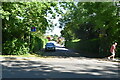
Living in Royston Meridian Ward offers a distinct, quiet residential experience. You are looking at a district borough unitary ward that spans just 4.2 square kilometres. This compact footprint defines the daily rhythm of life for those who call Royston Meridian Ward home. The area is not large, which means distances are short and the community feels contained. While specific population figures are absent from current records, the demographic profile tells a clear story about who resides here. The environment is characterised by a high rate of local ownership, suggesting a stable, established neighbourhood rather than a transient rental market. Daily life in Royston Meridian Ward revolves around convenience and familiarity. Residents benefit from a lack of planning constraints that might hinder future development nearby. There are no Ramsar wetland sites, areas of outstanding natural beauty, or protected woodlands within boundaries. Similarly, there is no coverage of protected nature reserves. This absence of strict environmental protections means the ward is not bound by the same restrictions found in more ecologically sensitive regions. For you, this translates to a straightforward living environment where practicality takes precedence over complex conservation designations.
- Area Type
- District Borough Unitary Ward
- Area Size
- 4.2 km²
- Population
- Not available
- Population Density
- Not available
Demographics
The community profile of Royston Meridian Ward is quite settled, with a median age of 70. This figure indicates an older population compared to the national average. You should expect the majority of residents to be in the age range defined as 'Total', reflecting the broader age distribution captured in survey data. Home ownership sits at an impressive 83 per cent of households. This high percentage confirms that Royston Meridian Ward is predominantly an owner-occupied area. When you consider buying homes in Royston Meridian Ward, you are likely entering an estate where neighbours have lived there for decades. The household composition and accommodation type data are recorded as totals, meaning the full breakdown of family structures or property types is aggregated in the available source. Despite this aggregated view, the 83 per cent ownership rate is a powerful signal. It suggests low rental churn and a community invested in the long-term stability of Royston Meridian Ward. This demographic reality creates a specific market dynamic where you are competing with other serious buyers. The area is not a zone of frequent student turnover or recent arrivals. The high ownership level provides a sense of permanence that defines the social fabric of Royston Meridian Ward today.
Household Size
Accommodation Type
Tenure
Ethnic Group
Religion
Household Composition
Age
Household Deprivation
NS-SEC
Explore more demographic insights in this area
Go to Demographics tabPlanning
Planning Constraints
- Flood RiskPremium
- Ramsar Wetland SitesPremium
- Area of Outstanding Natural BeautyPremium
- Protected Nature ReservePremium
- Protected WoodlandPremium
- Crime RiskPremium