Area Overview for Roudham and Larling
Photos of Roudham and Larling

Area Information
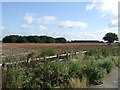
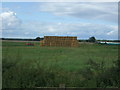
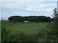
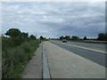
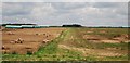
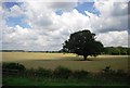
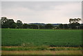
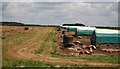
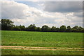
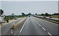
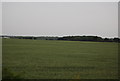
Roudham and Larling is a civil parish situated within the broader landscape of Norfolk, covering a total area of 15.2 square kilometres. Living in this parish offers a setting defined by its rural character, yet the specific geography remains one of quietness rather than significant urban development. The community functions as a distinct parish unit where daily life moves at a steadier pace away from the pressures of major metropolitan centres. For those considering homes in Roudham and Larling, the area presents a straightforward proposition of space and low-density living. The parish does not contain major industrial sites or dense commercial hubs, meaning residents typically rely on vehicles for commutes and most amenities are found further away. The physical footprint of 15.2 km² suggests a spread-out environment where neighbours may be noticeably distant from one another. You will find yourself in a jurisdiction that prioritises its classification as a parish, which often implies a focus on local governance and community preservation over rapid economic expansion. The absence of high-rise structures or bustling town centres is a defining feature, appealing to those who value tranquility. This context sets the stage for understanding the broader community dynamics found within these boundaries.
- Area Type
- Parish
- Area Size
- 15.2 km²
- Population
- Not available
- Population Density
- Not available
Demographics
The community profile of Roudham and Larling reflects a significant shift towards retirement living. The population has a median age of 70 years, making this one of the older demographic clusters in the region. This age distribution shapes the daily rhythm of the parish, with fewer children and young families present compared to more centralised towns. Nearly two-thirds of the total population fall into the older age bracket, which heavily influences local demand for specific services and housing adaptations. Home ownership stands at a robust 64 per cent, indicating that the majority of residents have purchased their current properties rather than renting. This high rate of ownership suggests financial stability among the current population and a deep attachment to the local area. The data shows a predominance of older households, meaning the social fabric is likely built around peer groups who have lived in the parish for decades. You are buying into an environment where neighbours have known each other since their early retirement years. The lack of younger household types in the dataset points to a slow regeneration cycle, where growth depends on incoming retirees or downsizers looking for space. Understanding this age profile is essential for anyone evaluating the long-term lifestyle fit of Roudham and Larling.
Household Size
Accommodation Type
Tenure
Ethnic Group
Religion
Household Composition
Age
Household Deprivation
NS-SEC
Explore more demographic insights in this area
Go to Demographics tabPlanning
Planning Constraints
- Flood RiskPremium
- Ramsar Wetland SitesPremium
- Area of Outstanding Natural BeautyPremium
- Protected Nature ReservePremium
- Protected WoodlandPremium
- Crime RiskPremium