Area Overview for Roche South Ward
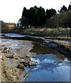
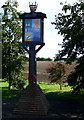
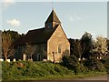
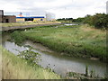
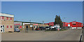
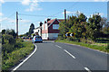
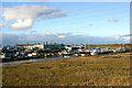
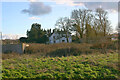
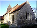
Photos of Roche South Ward

Area Information
Living in Roche South Ward offers a quiet, rural lifestyle centred around the extensive estates that define its landscape. This ward spans 23.3 km² and is situated within the borough of the **Borough of South Kesteven** in Lincolnshire, England. It is defined by the presence of **Rocheford Hall** and **Rolleston Hall**, two historic estates that shape the local geography. You will find numerous country houses scattered throughout the countryside in **Roche** and **Walling** as well. Daily life here moves at a slower pace compared to urban centres, offering plenty of space and a connection to the natural environment. The area is notable for its detached housing, which reflects its affluent, semi-rural character. ### The community in Roche South Ward is distinctly older than the UK average. The median age reaches 70, which indicates a significant proportion of residents are retired or nearing retirement. Age profiling shows that the Total age range is the most common demographic group within the ward. This suggests that the population consists largely of established households rather than young families or students. There is a high level of stability in the area, underpinned by a home ownership rate of 76%. This ownership level is notably higher than the national average for such wards, implying that many people have lived in these properties for long periods. Accommodation and household composition data reflect this stable ownership. With 76% of dwellings owner-occupied, the area functions more as a settlement for settled families and retirees than a transient rental marketplace. While diversity statistics and predominant ethnic group figures are part of the broader demographic picture, the primary characteristic remains the high concentration of older, owner-occupied homes. This creates a community defined by long-term residency and established resident profiles. ### The property market in Roche South Ward is characterised by a dominant owner-occupied sector. A full 76% of the housing stock consists of owner-occupied homes, which sets this ward apart from many other areas that rely heavily on the private rental market. This high ownership rate means that the demographic is likely to include long-term residents who are settled in their current locations. The accommodation types predominantly consist of detached and semi-detached properties, fitting the profile of the large houses found around **Roche and Walling**. For buyers considering **homes in Roche South Ward**, the market is driven by capital assets rather than a flow of tenants. You are likely to find properties that have remained in the same families for generations. This stability often translates to well-maintained estates and a lower level of transient traffic. Because ownership is so prevalent, potential buyers face competition from resident residents looking to move locally rather than from a large pool of short-term renters. The 23.3 km² area provides sufficient scope for various detached properties to coexist, catering to those seeking independent living in a rural setting. ### Digital connectivity in Roche South Ward is a significant strength for residents working from home. The area boasts a fixed broadband quality score of 96 out of 100. On a scale where 100 is the best possible performance, this score indicates excellent internet reliability and speed. Such high performance means you can expect robust connections for video conferencing, streaming, and large file transfers without interruption. This level of connectivity is vital for those relying on the internet for their daily work or leisure activities. Mobile connectivity also performs well across the ward, supporting the needs of drivers navigating the rural landscape between estates like **Rolleston Hall** and **Roche**. With these strong digital foundations, the area functions effectively as a digital outpost despite its geographical location in the **Borough of South Kesteven**. Residents do not need to compromise on technology when choosing to live here. ### Safety and environmental factors require careful consideration when looking at Roche South Ward. The crime risk assessment rates the area as WARNING with a score of 58 on a scale where lower scores indicate less risk. This places the area in the medium crime risk category, where crime rates are around average and standard security precautions are advisable. While the numbers suggest a typical level of caution, it is important to remain vigilant, especially in rural settings. Environmental constraints present specific planning limitations. The ward carries a WARNING level flood risk, with a score of 21.61, indicating medium flood risk coverage. This means properties must be assessed carefully for potential water issues during heavy rainfall. Additionally, the area contains Ramsar wetland sites, protected nature reserves, and protected woodland, all marked as WARNING statuses with scores below 10. These areas, including specific plots within **Roche and Walling**, are legally protected to preserve their natural state. These designations can restrict development plans or landscaping options. Conversely, there is no Area of Outstanding Natural Beauty coverage, which shows a PASS level with a score of 0. This indicates that while the environment is valuable, it is not subject to the strictest AONB planning constraints. ### What is the age profile of the community in Roche South Ward?The area has a significantly older population compared to the national average. With a median age of 70 and the Total age range being the most common, the community is primarily composed of retired individuals and those nearing retirement age. This demographic profile suggests a stable environment with a focus on permanent residency. Is it easy to work from home in this area?Digital infrastructure in Roche South Ward is excellent for remote workers. The ward achieves a fixed broadband quality score of 96, which represents excellent performance on a 0-100 scale. This ensures reliable high-speed internet for video calls and large data transfers, making the rural location highly suitable for professionals who do not require daily commuting. What are the main safety concerns for new residents?New residents should be aware of medium-level risks in the area. The ward carries a warning regarding crime with a risk score of 58, indicating average crime rates where standard security is advisable. Furthermore, the area has a flood risk score of 21.61, suggesting medium coverage. Additionally, planning restrictions apply due to the presence of Ramsar wetlands, protected nature reserves, and protected woodland. Who typically owns the homes in this ward?Home ownership is extremely high in Roche South Ward, standing at 76%. This means the vast majority of the housing stock is owner-occupied rather than rented. This high level of ownership creates a community of long-term residents, with most people living in detached and semi-detached properties that often belong to families who have stayed for years.
- Area Type
- District Borough Unitary Ward
- Area Size
- 23.3 km²
- Population
- Not available
- Population Density
- Not available
Demographics
The community in Roche South Ward is distinctly older than the UK average. The median age reaches 70, which indicates a significant proportion of residents are retired or nearing retirement. Age profiling shows that the Total age range is the most common demographic group within the ward. This suggests that the population consists largely of established households rather than young families or students. There is a high level of stability in the area, underpinned by a home ownership rate of 76%. This ownership level is notably higher than the national average for such wards, implying that many people have lived in these properties for long periods. Accommodation and household composition data reflect this stable ownership. With 76% of dwellings owner-occupied, the area functions more as a settlement for settled families and retirees than a transient rental marketplace. While diversity statistics and predominant ethnic group figures are part of the broader demographic picture, the primary characteristic remains the high concentration of older, owner-occupied homes. This creates a community defined by long-term residency and established resident profiles. ### The property market in Roche South Ward is characterised by a dominant owner-occupied sector. A full 76% of the housing stock consists of owner-occupied homes, which sets this ward apart from many other areas that rely heavily on the private rental market. This high ownership rate means that the demographic is likely to include long-term residents who are settled in their current locations. The accommodation types predominantly consist of detached and semi-detached properties, fitting the profile of the large houses found around **Roche and Walling**. For buyers considering **homes in Roche South Ward**, the market is driven by capital assets rather than a flow of tenants. You are likely to find properties that have remained in the same families for generations. This stability often translates to well-maintained estates and a lower level of transient traffic. Because ownership is so prevalent, potential buyers face competition from resident residents looking to move locally rather than from a large pool of short-term renters. The 23.3 km² area provides sufficient scope for various detached properties to coexist, catering to those seeking independent living in a rural setting. ### Digital connectivity in Roche South Ward is a significant strength for residents working from home. The area boasts a fixed broadband quality score of 96 out of 100. On a scale where 100 is the best possible performance, this score indicates excellent internet reliability and speed. Such high performance means you can expect robust connections for video conferencing, streaming, and large file transfers without interruption. This level of connectivity is vital for those relying on the internet for their daily work or leisure activities. Mobile connectivity also performs well across the ward, supporting the needs of drivers navigating the rural landscape between estates like **Rolleston Hall** and **Roche**. With these strong digital foundations, the area functions effectively as a digital outpost despite its geographical location in the **Borough of South Kesteven**. Residents do not need to compromise on technology when choosing to live here. ### Safety and environmental factors require careful consideration when looking at Roche South Ward. The crime risk assessment rates the area as WARNING with a score of 58 on a scale where lower scores indicate less risk. This places the area in the medium crime risk category, where crime rates are around average and standard security precautions are advisable. While the numbers suggest a typical level of caution, it is important to remain vigilant, especially in rural settings. Environmental constraints present specific planning limitations. The ward carries a WARNING level flood risk, with a score of 21.61, indicating medium flood risk coverage. This means properties must be assessed carefully for potential water issues during heavy rainfall. Additionally, the area contains Ramsar wetland sites, protected nature reserves, and protected woodland, all marked as WARNING statuses with scores below 10. These areas, including specific plots within **Roche and Walling**, are legally protected to preserve their natural state. These designations can restrict development plans or landscaping options. Conversely, there is no Area of Outstanding Natural Beauty coverage, which shows a PASS level with a score of 0. This indicates that while the environment is valuable, it is not subject to the strictest AONB planning constraints. ### What is the age profile of the community in Roche South Ward?The area has a significantly older population compared to the national average. With a median age of 70 and the Total age range being the most common, the community is primarily composed of retired individuals and those nearing retirement age. This demographic profile suggests a stable environment with a focus on permanent residency. Is it easy to work from home in this area?Digital infrastructure in Roche South Ward is excellent for remote workers. The ward achieves a fixed broadband quality score of 96, which represents excellent performance on a 0-100 scale. This ensures reliable high-speed internet for video calls and large data transfers, making the rural location highly suitable for professionals who do not require daily commuting. What are the main safety concerns for new residents?New residents should be aware of medium-level risks in the area. The ward carries a warning regarding crime with a risk score of 58, indicating average crime rates where standard security is advisable. Furthermore, the area has a flood risk score of 21.61, suggesting medium coverage. Additionally, planning restrictions apply due to the presence of Ramsar wetlands, protected nature reserves, and protected woodland. Who typically owns the homes in this ward?Home ownership is extremely high in Roche South Ward, standing at 76%. This means the vast majority of the housing stock is owner-occupied rather than rented. This high level of ownership creates a community of long-term residents, with most people living in detached and semi-detached properties that often belong to families who have stayed for years.
Household Size
Accommodation Type
Tenure
Ethnic Group
Religion
Household Composition
Age
Household Deprivation
NS-SEC
Explore more demographic insights in this area
Go to Demographics tabPlanning
Planning Constraints
- Flood RiskPremium
- Ramsar Wetland SitesPremium
- Area of Outstanding Natural BeautyPremium
- Protected Nature ReservePremium
- Protected WoodlandPremium
- Crime RiskPremium