Area Overview for RM4 1HG
Photos of RM4 1HG
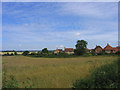
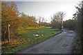
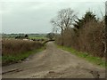
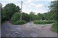
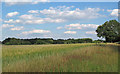
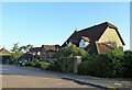
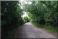
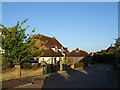
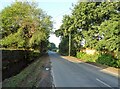
9 photos from this area
Area Information
Key information about the RM4 1HG including its size, population, and administrative classification.
- Area Type
- Postcode
- Area Size
- 6.3 hectares
- Population
- 2519
- Population Density
- 52 people/km²
House Prices in RM4 1HG
20
Properties
£572,903
Average Sold Price
£255,000
Lowest Price
£1,100,000
Highest Price
Showing 20 properties
| Address | Type | Beds | Baths | Last Sale Price | Last Sale Date | |
|---|---|---|---|---|---|---|
| 11 The Paddocks, Stapleford Abbotts, Romford, RM4 1HG | Detached | 5 | 3 | £950,000 | Jun 2024 | |
| 16 The Paddocks, Stapleford Abbotts, Romford, RM4 1HG | Detached | 4 | 3 | £830,000 | Jun 2024 | |
| 13 The Paddocks, Stapleford Abbotts, Romford, RM4 1HG | Detached | 5 | 3 | £1,100,000 | Apr 2024 | |
| 10 The Paddocks, Stapleford Abbotts, Romford, RM4 1HG | house | - | - | £1,075,000 | Sep 2021 | |
| 19 The Paddocks, Stapleford Abbotts, Romford, RM4 1HG | Detached | 4 | - | £807,500 | Feb 2021 | |
| 20 The Paddocks, Stapleford Abbotts, Romford, RM4 1HG | Detached | 4 | 4 | £840,000 | Apr 2019 | |
| 17 The Paddocks, Stapleford Abbotts, Romford, RM4 1HG | Detached | 5 | 3 | £730,000 | Jul 2018 | |
| 5 The Paddocks, Stapleford Abbotts, Romford, RM4 1HG | Detached | - | - | £549,995 | Jun 2005 | |
| 4 The Paddocks, Stapleford Abbotts, Romford, RM4 1HG | house | - | - | £553,000 | Mar 2005 | |
| 15 The Paddocks, Stapleford Abbotts, Romford, RM4 1HG | house | - | - | £470,000 | May 2002 |
Page 1 of 2
Energy Efficiency in RM4 1HG
Amenities
Schools
| Rank | School | Type | Entry gender | Ages |
|---|
Explore more schools in this area
Go to Schools tabDemographics
Household Size
Family (3-5 people)
most common
Accommodation Type
Houses
most common
Tenure
77
majority
Ethnic Group
White
most common
Religion
N/A
most common
Household Composition
N/A
most common
Age
47
median
Adults (30-64 years)
most common
Household Deprivation
N/A
with no deprivation
NS-SEC
35
in Lower managerial occupations
Explore more demographic insights in this area
Go to Demographics tabPlanning
Planning Constraints
- Flood RiskPremium
- Ramsar Wetland SitesPremium
- Area of Outstanding Natural BeautyPremium
- Protected Nature ReservePremium
- Protected WoodlandPremium