Area Overview for RM4 1EH
Photos of RM4 1EH
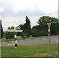
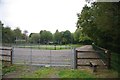
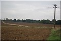
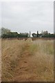
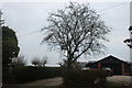
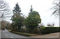
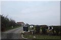
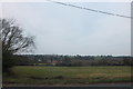
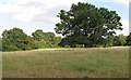
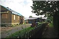
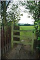
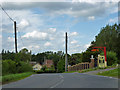
12 photos from this area
Area Information
Key information about the RM4 1EH including its size, population, and administrative classification.
- Area Type
- Postcode
- Area Size
- 18.6 hectares
- Population
- 2519
- Population Density
- 52 people/km²
House Prices in RM4 1EH
27
Properties
£766,388
Average Sold Price
£249,999
Lowest Price
£1,700,000
Highest Price
Showing 27 properties
| Address | Type | Beds | Baths | Last Sale Price | Last Sale Date | |
|---|---|---|---|---|---|---|
| Rayside, Oak Hill Road, Stapleford Abbotts, Romford, RM4 1EH | Detached | 4 | 2 | £950,000 | Mar 2022 | |
| El Camino, Oak Hill Road, Stapleford Abbotts, Romford, RM4 1EH | Detached | 4 | 3 | £1,350,000 | Jan 2021 | |
| Hill View, Oak Hill Road, Stapleford Abbotts, Romford, RM4 1EH | Bungalow | - | - | £770,000 | Dec 2018 | |
| The Lodge, Oak Hill Road, Stapleford Abbotts, RM4 1EH | Detached | 4 | 1 | £815,000 | Feb 2018 | |
| Redroofs, Oak Hill Road, Stapleford Abbotts, Romford, RM4 1EH | Bungalow | - | - | £650,000 | Nov 2017 | |
| Valley View, Oak Hill Road, Stapleford Abbotts, Romford, RM4 1EH | Detached | 5 | 3 | £813,597 | Jun 2017 | |
| Fallow Field, Oak Hill Road, Stapleford Abbotts, Romford, RM4 1EH | Detached | 4 | 2 | £600,000 | Dec 2016 | |
| Rydal Mount, Oak Hill Road, Stapleford Abbotts, Romford, RM4 1EH | Detached | - | - | £627,500 | Oct 2016 | |
| Ralwyn, Oak Hill Road, Stapleford Abbotts, Romford, RM4 1EH | Bungalow | 2 | - | £540,000 | Mar 2016 | |
| Oakhill Manor, Oak Hill Road, Stapleford Abbotts, Romford, RM4 1EH | Detached | 7 | 5 | £1,700,000 | Sep 2015 |
Page 1 of 3
Energy Efficiency in RM4 1EH
Amenities
Schools
| Rank | School | Type | Entry gender | Ages |
|---|
Explore more schools in this area
Go to Schools tabDemographics
Household Size
Family (3-5 people)
most common
Accommodation Type
Houses
most common
Tenure
77
majority
Ethnic Group
White
most common
Religion
N/A
most common
Household Composition
N/A
most common
Age
47
median
Adults (30-64 years)
most common
Household Deprivation
N/A
with no deprivation
NS-SEC
35
in Lower managerial occupations
Explore more demographic insights in this area
Go to Demographics tabPlanning
Planning Constraints
- Flood RiskPremium
- Ramsar Wetland SitesPremium
- Area of Outstanding Natural BeautyPremium
- Protected Nature ReservePremium
- Protected WoodlandPremium