Area Overview for RM20 3LG
Photos of RM20 3LG


Area Information
The postcode district RM20 3LG represents a compact residential cluster covering just 4.5 hectares within the Thurrock Local Enterprise Partnership region. This small geographic footprint hosts a population of 1,832 residents, creating a tightly knit neighbourhood rather than a sprawling suburb. You will find density favouring community interaction, with 248 people living per square kilometre. This area functions as a quiet residential pocket within the wider Essex and London commuter belt. Most living in RM20 3LG seeks a balance between domestic privacy and proximity to larger employment centres. The locality avoids the chaos of major traffic arteries while maintaining functional access to the wider transport network. Daily life here revolves around practical commuting, local errands, and the specific advantages of a smaller, defined zone. You can expect a settled atmosphere where neighbours know each other, distinct from the anonymity of larger urban centres. The area stands apart from the chaotic sprawl of the mainland, offering a quiet retreat while remaining serviceable. This specific postcode serves as a micro-community within the broader London-East Sector, providing a stable environment for families and retirees alike. The defined boundaries ensure a sense of place that larger urban districts often lack.
- Area Type
- Postcode
- Area Size
- 4.5 hectares
- Population
- 1832
- Population Density
- 248 people/km²
The property market in RM20 3LG is characterised by a distinct lack of rental pressure, evidenced by a home ownership rate of 66%. This high ownership percentage suggests the housing stock remains largely within the owner-occupier market rather than the private rental sector. Most homes in RM20 3LG are traditional houses, reflecting the area's development timeline and planning history. You will find few purpose-built flats or modern apartments within this specific postcode boundary, as the accommodation type is predominantly detached or semi-detached properties. This composition makes the area particularly attractive to families seeking gardens and space, rather than young professionals looking for urban convenience. The limited size of 4.5 hectares restricts the total number of available homes, which may drive competition for any new listings. Buyers here typically look for established properties rather than speculative developments. The market reflects a mature ecosystem where existing asset values are prized over speculative growth. Conservation or planning constraints often protect this housing stock from rapid transformation. Consequently, purchase prices tend to remain stable, driven by demand from families who value the quiet, house-led environment of RM20 3LG.
House Prices in RM20 3LG
No properties found in this postcode.
Energy Efficiency in RM20 3LG
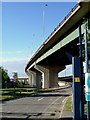
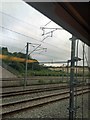
Residents of RM20 3LG enjoy convenient access to a range of retail, rail, ferry, and metro facilities within practical reach. For shopping needs, you are within easy distance of Costco Thurrock, M&S Thurrock, and Lidl Lakeside, covering major supermarket requirements and home goods. Transport links are extensive, with five rail stations available, including Chafford Hundred Railway Station, Purfleet Railway Station, and Stone Crossing Railway Station. These stations facilitate straightforward commutes to central London and across the county. Ferry options include Tilbury Ferry Terminal, West Street Pier, and Town Pier, offering river crossings for specific travel routes. Additionally, three metro stations such as Hornchurch, Upminster Bridge, and Elm Park Station provide integrated tube access. This density of transport options means you rarely need to rely on a car for essential journeys. Your daily routine benefits from a well-connected hub that serves commercial and residential traffic efficiently. The presence of large retailers like Costco and M&S ensures you can stock up on essentials without travelling deep into London.
Amenities
Schools
Families considering schools near RM20 3LG should primarily focus on Harris Academy Riverside, an academy with a rated status of Good. This institution serves as a key educational anchor for the local cluster. For older students, the National College for the Creative and Cultural Industries operates nearby, functioning specifically as a sixth-form college. This mix provides a clear pathway from primary and secondary education into specialist higher-level studies. The presence of a Good-rated academy ensures that younger learners have access to robust secondary education within a convenient distance. Residents do not need to travel far to secure Quality schooling, as these institutions fill the immediate educational needs of the neighbourhood. The sixth-form option allows for seamless transitions into further education without relocating. This educational infrastructure supports the area's demographic, which is heavily weighted towards adults with children. You will find no spectacular prestige schools listed, but rather practical, functional institutions that meet the standard requirements for the local population. The combination of a secondary academy and a specialist sixth-form college creates a complete, albeit limited, educational chain for families of school age.
| Rank | School | Type | Entry gender | Ages |
|---|
Explore more schools in this area
Go to Schools tabDemographics
The community in RM20 3LG is defined by an older demographic, with a median age of 47 years. Adults between the ages of 30 and 64 constitute the most common age range, suggesting a neighbourhood dominated by families raising children and established workers. High home ownership levels confirm a stable population, with 66% of residents owning their homes outright or via mortgage. This figure indicates a strong sense of community investment and long-term settlement. The majority of accommodation consists of houses, which aligns perfectly with the preference of the resident age group for space and privacy. The predominant ethnic group in the area is White, reflecting the traditional character of the Thurrock coastline settlements. This demographic profile suggests a conservative, family-oriented environment where patience and commitment are key local values. The low population density of 248 people per square kilometre supports this quiet, residential lifestyle. Children and young adults likely form a smaller proportion of the demographic, with the bulk of the population falling into the middle-to-late adult years. This structure means the area prioritises stability over rapid change or transient student housing markets.
Household Size
Accommodation Type
Tenure
Ethnic Group
Religion
Household Composition
Age
Household Deprivation
NS-SEC
Explore more demographic insights in this area
Go to Demographics tabPlanning
Planning Constraints
- Flood RiskPremium
- Ramsar Wetland SitesPremium
- Area of Outstanding Natural BeautyPremium
- Protected Nature ReservePremium
- Protected WoodlandPremium