Area Overview for RM19 1GU
Photos of RM19 1GU
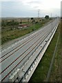
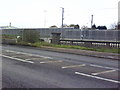
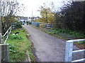


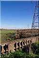
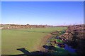


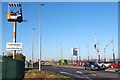
50 photos from this area
Area Information
Key information about the RM19 1GU including its size, population, and administrative classification.
- Area Type
- Postcode
- Area Size
- 1.9 hectares
- Population
- 2546
- Population Density
- 3259 people/km²
House Prices in RM19 1GU
36
Properties
£204,276
Average Sold Price
£43,500
Lowest Price
£385,000
Highest Price
Showing 36 properties
| Address | Type | Beds | Baths | Last Sale Price | Last Sale Date | |
|---|---|---|---|---|---|---|
| 94 Water Lane, Purfleet On Thames, RM19 1GU | Terraced | 2 | 1 | £289,000 | Sep 2023 | |
| 108 Water Lane, Purfleet On Thames, RM19 1GU | Terraced | 3 | 1 | £335,000 | Nov 2022 | |
| 104 Water Lane, Purfleet On Thames, RM19 1GU | house | - | - | £385,000 | Jul 2022 | |
| 92 Water Lane, Purfleet On Thames, RM19 1GU | house | 2 | 1 | £300,000 | Apr 2022 | |
| 114 Water Lane, Purfleet On Thames, RM19 1GU | house | 3 | - | £340,000 | Feb 2022 | |
| 142 Water Lane, Purfleet On Thames, RM19 1GU | house | 3 | - | £265,000 | Oct 2021 | |
| 162 Water Lane, Purfleet On Thames, RM19 1GU | Semi-detached | 1 | 1 | £242,000 | Oct 2021 | |
| 154 Water Lane, Purfleet On Thames, RM19 1GU | Terraced | 2 | 1 | £270,000 | Jun 2021 | |
| 160 Water Lane, Purfleet On Thames, RM19 1GU | house | - | - | £250,000 | Jun 2021 | |
| 110 Water Lane, Purfleet On Thames, RM19 1GU | Terraced | 3 | 2 | £265,000 | Jun 2020 |
Page 1 of 4
Energy Efficiency in RM19 1GU
Amenities
Schools
| Rank | School | Type | Entry gender | Ages |
|---|
Explore more schools in this area
Go to Schools tabDemographics
Household Size
Family (3-5 people)
most common
Accommodation Type
Flats
most common
Tenure
51
majority
Ethnic Group
White
most common
Religion
N/A
most common
Household Composition
N/A
most common
Age
47
median
Adults (30-64 years)
most common
Household Deprivation
N/A
with no deprivation
NS-SEC
29
in Lower managerial occupations
Explore more demographic insights in this area
Go to Demographics tabPlanning
Planning Constraints
- Flood RiskPremium
- Ramsar Wetland SitesPremium
- Area of Outstanding Natural BeautyPremium
- Protected Nature ReservePremium
- Protected WoodlandPremium