Area Overview for RM19 1AR
Photos of RM19 1AR


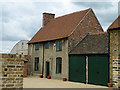

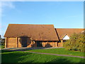
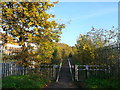
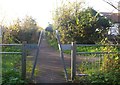
22 photos from this area
Area Information
Key information about the RM19 1AR including its size, population, and administrative classification.
- Area Type
- Postcode
- Area Size
- 2.4 hectares
- Population
- 2546
- Population Density
- 3259 people/km²
House Prices in RM19 1AR
73
Properties
£188,440
Average Sold Price
£90,000
Lowest Price
£325,000
Highest Price
Showing 73 properties
| Address | Type | Beds | Baths | Last Sale Price | Last Sale Date | |
|---|---|---|---|---|---|---|
| 93 Griffiths Road, Purfleet On Thames, RM19 1AR | Flat | 1 | 1 | £180,000 | Oct 2025 | |
| 45 Griffiths Road, Purfleet On Thames, RM19 1AR | Flat | 2 | 2 | £235,000 | Mar 2025 | |
| 47 Griffiths Road, Purfleet On Thames, RM19 1AR | Flat | 1 | 1 | £177,000 | Sep 2023 | |
| 83 Griffiths Road, Purfleet On Thames, RM19 1AR | Flat | - | - | £190,000 | May 2023 | |
| 43 Griffiths Road, Purfleet On Thames, RM19 1AR | Flat | 2 | 2 | £255,000 | Oct 2022 | |
| 53 Griffiths Road, Purfleet On Thames, RM19 1AR | Flat | - | - | £252,000 | Sep 2022 | |
| 59 Griffiths Road, Purfleet On Thames, RM19 1AR | Flat | - | - | £167,000 | Feb 2022 | |
| 16 Griffiths Road, Purfleet On Thames, RM19 1AR | house | - | - | £325,000 | Mar 2021 | |
| 20 Griffiths Road, Purfleet On Thames, RM19 1AR | house | - | - | £325,000 | Feb 2021 | |
| 35 Griffiths Road, Purfleet On Thames, RM19 1AR | Flat | 1 | 1 | £160,000 | Jan 2021 |
Page 1 of 8
Energy Efficiency in RM19 1AR
Amenities
Schools
| Rank | School | Type | Entry gender | Ages |
|---|
Explore more schools in this area
Go to Schools tabDemographics
Household Size
Family (3-5 people)
most common
Accommodation Type
Flats
most common
Tenure
51
majority
Ethnic Group
White
most common
Religion
N/A
most common
Household Composition
N/A
most common
Age
47
median
Adults (30-64 years)
most common
Household Deprivation
N/A
with no deprivation
NS-SEC
29
in Lower managerial occupations
Explore more demographic insights in this area
Go to Demographics tabPlanning
Planning Constraints
- Flood RiskPremium
- Ramsar Wetland SitesPremium
- Area of Outstanding Natural BeautyPremium
- Protected Nature ReservePremium
- Protected WoodlandPremium