Area Overview for RM18 8RP
Photos of RM18 8RP

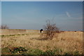

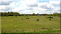
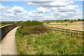
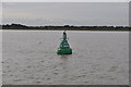
17 photos from this area
Area Information
Key information about the RM18 8RP including its size, population, and administrative classification.
- Area Type
- Postcode
- Area Size
- 46.6 hectares
- Population
- 1781
- Population Density
- 196 people/km²
House Prices in RM18 8RP
10
Properties
£279,214
Average Sold Price
£92,000
Lowest Price
£379,500
Highest Price
Showing 10 properties
| Address | Type | Beds | Baths | Last Sale Price | Last Sale Date | |
|---|---|---|---|---|---|---|
| Clovelly, Princess Margaret Road, East Tilbury, RM18 8RP | Bungalow | 2 | - | £333,000 | Jul 2024 | |
| Krisand, Princess Margaret Road, East Tilbury, RM18 8RP | Semi-detached | 4 | 2 | £379,500 | Oct 2023 | |
| Santuzza, Princess Margaret Road, East Tilbury, RM18 8RP | house | - | - | £370,000 | Mar 2021 | |
| Argus, Princess Margaret Road, East Tilbury, RM18 8RP | house | - | - | £280,000 | May 2019 | |
| Alpha, Princess Margaret Road, East Tilbury, RM18 8RP | Semi-detached | 3 | 1 | £275,000 | Nov 2015 | |
| Cornfields, Princess Margaret Road, East Tilbury, RM18 8RP | Semi-detached | - | - | £225,000 | Jul 2007 | |
| Meri Joki, Princess Margaret Road, East Tilbury, RM18 8RP | Semi-detached | - | - | £92,000 | Nov 1998 | |
| Kanda, Princess Margaret Road, East Tilbury, RM18 8RP | Semi-detached | - | - | - | - | |
| Trinovantes, Princess Margaret Road, East Tilbury, RM18 8RP | Semi-detached | - | - | - | - | |
| Amberway, Princess Margaret Road, East Tilbury, RM18 8RP | Detached | - | - | - | - |
Energy Efficiency in RM18 8RP
Amenities
Schools
| Rank | School | Type | Entry gender | Ages |
|---|
Explore more schools in this area
Go to Schools tabDemographics
Household Size
Family (3-5 people)
most common
Accommodation Type
Houses
most common
Tenure
79
majority
Ethnic Group
White
most common
Religion
N/A
most common
Household Composition
N/A
most common
Age
47
median
Adults (30-64 years)
most common
Household Deprivation
N/A
with no deprivation
NS-SEC
28
in Lower managerial occupations
Explore more demographic insights in this area
Go to Demographics tabPlanning
Planning Constraints
- Flood RiskPremium
- Ramsar Wetland SitesPremium
- Area of Outstanding Natural BeautyPremium
- Protected Nature ReservePremium
- Protected WoodlandPremium