Area Overview for RM18 8AX
Photos of RM18 8AX
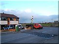

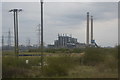
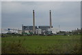
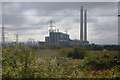


23 photos from this area
Area Information
Key information about the RM18 8AX including its size, population, and administrative classification.
- Area Type
- Postcode
- Area Size
- 2.9 hectares
- Population
- 1554
- Population Density
- 8825 people/km²
House Prices in RM18 8AX
63
Properties
£162,097
Average Sold Price
£20,750
Lowest Price
£380,000
Highest Price
Showing 63 properties
| Address | Type | Beds | Baths | Last Sale Price | Last Sale Date | |
|---|---|---|---|---|---|---|
| 78 Portsea Road, Tilbury, RM18 8AX | Terraced | 2 | 1 | £175,350 | Oct 2025 | |
| 59 Portsea Road, Tilbury, RM18 8AX | Terraced | 3 | 1 | £324,000 | Apr 2025 | |
| 28 Portsea Road, Tilbury, RM18 8AX | Terraced | 3 | 2 | £380,000 | Feb 2025 | |
| 72 Portsea Road, Tilbury, RM18 8AX | Terraced | 1 | 1 | £210,000 | Aug 2020 | |
| 39 Portsea Road, Tilbury, RM18 8AX | Terraced | 3 | 1 | £255,000 | Jul 2020 | |
| 40 Portsea Road, Tilbury, RM18 8AX | Terraced | 3 | 2 | £233,000 | Feb 2020 | |
| 35 Portsea Road, Tilbury, RM18 8AX | Terraced | 4 | 2 | £250,000 | May 2019 | |
| 20 Portsea Road, Tilbury, RM18 8AX | Terraced | 3 | 1 | £230,000 | Dec 2018 | |
| 76 Portsea Road, Tilbury, RM18 8AX | Terraced | 3 | 1 | £240,000 | Nov 2018 | |
| Garjo, Portsea Road, Tilbury, RM18 8AX | Semi-detached | 3 | 2 | £315,000 | Aug 2018 |
Page 1 of 7
Energy Efficiency in RM18 8AX
Amenities
Schools
| Rank | School | Type | Entry gender | Ages |
|---|
Explore more schools in this area
Go to Schools tabDemographics
Household Size
Family (3-5 people)
most common
Accommodation Type
Houses
most common
Tenure
65
majority
Ethnic Group
White
most common
Religion
N/A
most common
Household Composition
N/A
most common
Age
47
median
Adults (30-64 years)
most common
Household Deprivation
N/A
with no deprivation
NS-SEC
23
in Lower managerial occupations
Explore more demographic insights in this area
Go to Demographics tabPlanning
Planning Constraints
- Flood RiskPremium
- Ramsar Wetland SitesPremium
- Area of Outstanding Natural BeautyPremium
- Protected Nature ReservePremium
- Protected WoodlandPremium