Area Overview for RM17 6SY
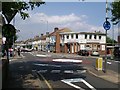
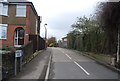
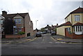
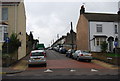
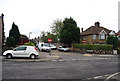
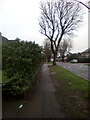
Photos of RM17 6SY


Area Information
RM17 6SY represents a focused residential cluster defined by its density and specific location within the wider postcode framework. This small area spans just 7387 square metres, yet it accommodates a population of 1445 residents. The result is a neighbourhood with a high population density, standing at 195616 people per square kilometre. This concentration creates an environment that functions efficiently without the sprawl often found in larger suburban developments. You are stepping into a locale where space is at a premium, yet the community remains tightly knit due to the sheer proximity of households to one another. The distinctive character of RM17 6SY comes from its status as a self-contained pocket of residential living. It is not a sprawling town but a defined cluster within England. Prospective buyers here appreciate the clarity of boundaries and the immediate sense of established neighbourhood that comes with such a concentrated population. The layout supports a lifestyle where daily routines are manageable within a compact footprint. This area offers a specific type of urban convenience where the distinction between being a local resident and being part of a larger community is blurred by the sheer number of people living in close quarters. You will find that life here moves with a purpose dictated by the area's size and the volume of its inhabitants.
- Area Type
- Postcode
- Area Size
- 7387 m²
- Population
- 1445
- Population Density
- 5573 people/km²
The property market in RM17 6SY is heavily skewed towards ownership, with 76 per cent of the population owning their homes. This statistic highlights an area where residents have invested in property as a long-term asset rather than treating housing purely as a rental opportunity. The accommodation type is universally houses, which shapes the visual character and the daily experience for anyone looking at homes in RM17 6SY. You will predominantly find detached or semi-detached structures rather than apartments or terraced flats common in high-density urban centres. This housing stock supports a lifestyle centred on private gardens and extended families, aligning perfectly with the median age of 47 years found in the demographic data. The market reflects a settled community where turnover is likely slower because owners are not constantly moving. Schools near RM17 6SY would cater to a demographic where children are likely to stay in the area through their education years. For buyers entering this market, the dominance of houses and the high ownership rate suggest a stable investment environment. The lack of rental uncertainty means that noise levels and community dynamics tend to be consistent over time. If you are purchasing here, you are joining an established stock of homes designed for permanence rather than short-term leasing agreements.
House Prices in RM17 6SY
Showing 42 properties
| Address | Type | Beds | Baths | Last Sale Price | Last Sale Date | |
|---|---|---|---|---|---|---|
| 104 Whitehall Lane, Grays, RM17 6SY | Maisonette | 1 | 1 | £165,000 | Mar 2025 | |
| 96 Whitehall Lane, Grays, RM17 6SY | Flat | 1 | - | £160,000 | Apr 2024 | |
| 168 Whitehall Lane, Grays, RM17 6SY | Maisonette | 2 | 1 | £245,000 | Oct 2023 | |
| 132 Whitehall Lane, Grays, RM17 6SY | Flat | - | - | £240,500 | Aug 2022 | |
| 144 Whitehall Lane, Grays, RM17 6SY | Flat | - | - | £158,000 | Aug 2021 | |
| 92 Whitehall Lane, Grays, RM17 6SY | Flat | - | - | £169,995 | Jun 2021 | |
| 134 Whitehall Lane, Grays, RM17 6SY | Flat | - | - | £175,000 | May 2021 | |
| 154 Whitehall Lane, Grays, RM17 6SY | Flat | 1 | - | £164,500 | Apr 2021 | |
| 94 Whitehall Lane, Grays, RM17 6SY | Maisonette | 1 | 1 | £180,000 | Jul 2020 | |
| 160 Whitehall Lane, Grays, RM17 6SY | Flat | - | - | £165,000 | Sep 2017 |
Energy Efficiency in RM17 6SY
Living in RM17 6SY places you within easy reach of a diverse range of essential amenities and transport hubs. For your daily shopping needs, you can access Tesco Southend, Co-op Socketts, and Iceland Grays, providing full coverage for groceries and household essentials. Retail options include five key locations within practical reach, ensuring you do not need to travel far for basic supplies. Transport links are equally convenient, with five railway stations nearby including Grays Railway Station, Tilbury Town Railway Station, and Chafford Hundred Railway Station. These connections offer flexibility for commuters heading towards London or other regional destinations. Ferry services add another dimension to your mobility, with three terminals including Tilbury Ferry Terminal, West Street Pier, and Town Pier available for residents. This mix of rail and water transport creates a robust network for getting around England. Beyond commercial services, the area is anchored by a residential cluster that supports local interaction. The presence of these specific venues transforms the daily routine into a manageable experience where work, leisure, and commerce are all accessible without excessive travel time. You benefit from a lifestyle where convenience is built into the geography of your postcode.
Amenities
Schools
| Rank | School | Type | Entry gender | Ages |
|---|
Explore more schools in this area
Go to Schools tabDemographics
The community in RM17 6SY is characterised by a mature demographic profile with a median age of 47 years. The majority of residents fall into the adult range of 30 to 64 years, suggesting a neighbourhood dominated by families and established professionals rather than students or elderly retirees. Stability defines this community further, evidenced by a home ownership rate of 76 per cent. Such a high proportion indicates that most people living in RM17 6SY have deep roots and long-term plans for their residence. The accommodation type is exclusively houses, which reinforces the family-oriented nature of the settlement and excludes the high-rise living often associated with younger, transient populations. Cultural homogeneity is another defining feature, with the predominant ethnic group being White. This demographic consistency contributes to a cohesive social fabric where neighbours likely know one another well. The absence of significant variation in age or cultural background creates a predictable and uniform living environment. For those considering homes in RM17 6SY, the data suggests a quiet, settled community where the adult population enjoys a high level of security and familiarity with their surroundings. The composition of the area points to a place where long-term residents value stability and consistency over rapid change or transient influences from younger demographics.
Household Size
Accommodation Type
Tenure
Ethnic Group
Religion
Household Composition
Age
Household Deprivation
NS-SEC
Explore more demographic insights in this area
Go to Demographics tabPlanning
Planning Constraints
- Flood RiskPremium
- Ramsar Wetland SitesPremium
- Area of Outstanding Natural BeautyPremium
- Protected Nature ReservePremium
- Protected WoodlandPremium