Area Overview for RM17 6RD
Photos of RM17 6RD
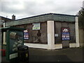
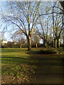
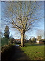
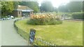
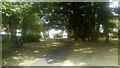
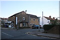
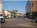
53 photos from this area
Area Information
Key information about the RM17 6RD including its size, population, and administrative classification.
- Area Type
- Postcode
- Area Size
- 1.0 hectares
- Population
- 2156
- Population Density
- 6323 people/km²
House Prices in RM17 6RD
46
Properties
£191,598
Average Sold Price
£36,000
Lowest Price
£495,000
Highest Price
Showing 46 properties
| Address | Type | Beds | Baths | Last Sale Price | Last Sale Date | |
|---|---|---|---|---|---|---|
| 120 Clarence Road, Grays, RM17 6RD | Terraced | 3 | 2 | £345,755 | Feb 2025 | |
| 117 Clarence Road, Grays, RM17 6RD | house | 5 | - | £285,000 | Jan 2025 | |
| 137 Clarence Road, Grays, RM17 6RD | house | - | - | £340,000 | Feb 2023 | |
| 149 Clarence Road, Grays, RM17 6RD | Terraced | 2 | 1 | £292,500 | Oct 2022 | |
| 127 Clarence Road, Grays, RM17 6RD | Terraced | 3 | 2 | £325,000 | Aug 2021 | |
| 121 Clarence Road, Grays, RM17 6RD | house | - | - | £312,500 | Jun 2021 | |
| 139 Clarence Road, Grays, RM17 6RD | house | - | - | £315,000 | May 2021 | |
| 136A Clarence Road, Grays, RM17 6RD | Flat | - | - | £495,000 | Dec 2020 | |
| 124 Clarence Road, Grays, RM17 6RD | Flat | 1 | 1 | £254,000 | Jan 2019 | |
| 135 Clarence Road, Grays, RM17 6RD | Terraced | 3 | 1 | £210,000 | Feb 2016 |
Page 1 of 5
Energy Efficiency in RM17 6RD
Amenities
Schools
| Rank | School | Type | Entry gender | Ages |
|---|
Explore more schools in this area
Go to Schools tabDemographics
Household Size
Family (3-5 people)
most common
Accommodation Type
Houses
most common
Tenure
47
majority
Ethnic Group
White
most common
Religion
N/A
most common
Household Composition
N/A
most common
Age
47
median
Adults (30-64 years)
most common
Household Deprivation
N/A
with no deprivation
NS-SEC
24
in Lower managerial occupations
Explore more demographic insights in this area
Go to Demographics tabPlanning
Planning Constraints
- Flood RiskPremium
- Ramsar Wetland SitesPremium
- Area of Outstanding Natural BeautyPremium
- Protected Nature ReservePremium
- Protected WoodlandPremium