Area Overview for RM17 6ES
Photos of RM17 6ES

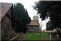
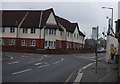
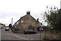
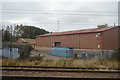

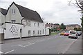
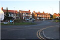
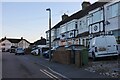

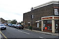
69 photos from this area
Area Information
Key information about the RM17 6ES including its size, population, and administrative classification.
- Area Type
- Postcode
- Area Size
- 3391 m²
- Population
- 1834
- Population Density
- 3916 people/km²
House Prices in RM17 6ES
19
Properties
£163,441
Average Sold Price
£39,500
Lowest Price
£310,000
Highest Price
Showing 19 properties
| Address | Type | Beds | Baths | Last Sale Price | Last Sale Date | |
|---|---|---|---|---|---|---|
| 19 Dock Road, Grays, RM17 6ES | Terraced | 2 | 1 | £310,000 | Jun 2025 | |
| 33 Dock Road, Grays, RM17 6ES | Terraced | 3 | 1 | £305,000 | Feb 2024 | |
| 9 Dock Road, Grays, RM17 6ES | Terraced | 2 | 1 | £306,000 | Aug 2022 | |
| 15 Dock Road, Grays, RM17 6ES | Terraced | 2 | 1 | £250,000 | Jun 2019 | |
| 37 Dock Road, Grays, RM17 6ES | house | - | - | £219,500 | Feb 2016 | |
| 39 Dock Road, Grays, RM17 6ES | house | - | - | £160,000 | Jan 2016 | |
| 31 Dock Road, Grays, RM17 6ES | Terraced | - | - | £160,000 | Oct 2015 | |
| 35 Dock Road, Grays, RM17 6ES | house | - | - | £159,995 | Dec 2011 | |
| 7 Dock Road, Grays, RM17 6ES | Terraced | - | - | £132,000 | Sep 2006 | |
| 29 Dock Road, Grays, RM17 6ES | Terraced | - | - | £153,000 | Aug 2005 |
Page 1 of 2
Energy Efficiency in RM17 6ES
Amenities
Schools
| Rank | School | Type | Entry gender | Ages |
|---|
Explore more schools in this area
Go to Schools tabDemographics
Household Size
Family (3-5 people)
most common
Accommodation Type
Houses
most common
Tenure
67
majority
Ethnic Group
White
most common
Religion
N/A
most common
Household Composition
N/A
most common
Age
47
median
Adults (30-64 years)
most common
Household Deprivation
N/A
with no deprivation
NS-SEC
28
in Lower managerial occupations
Explore more demographic insights in this area
Go to Demographics tabPlanning
Planning Constraints
- Flood RiskPremium
- Ramsar Wetland SitesPremium
- Area of Outstanding Natural BeautyPremium
- Protected Nature ReservePremium
- Protected WoodlandPremium