Area Overview for RM17 5SN
Photos of RM17 5SN
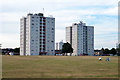
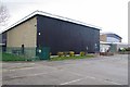
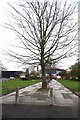
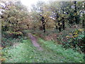
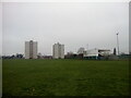
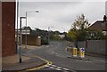

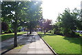
51 photos from this area
Area Information
Key information about the RM17 5SN including its size, population, and administrative classification.
- Area Type
- Postcode
- Area Size
- 8776 m²
- Population
- 1413
- Population Density
- 5725 people/km²
House Prices in RM17 5SN
25
Properties
£257,823
Average Sold Price
£59,995
Lowest Price
£467,000
Highest Price
Showing 25 properties
| Address | Type | Beds | Baths | Last Sale Price | Last Sale Date | |
|---|---|---|---|---|---|---|
| 226 Rectory Road, Grays, RM17 5SN | Detached | 3 | 1 | £467,000 | Jul 2025 | |
| 198 Rectory Road, Grays, RM17 5SN | Semi-detached | 3 | 1 | £335,000 | Dec 2021 | |
| 222 Rectory Road, Grays, RM17 5SN | Semi-detached | 3 | 1 | £390,000 | Sep 2021 | |
| 218 Rectory Road, Grays, RM17 5SN | Semi-detached | 3 | - | £382,500 | Sep 2019 | |
| 234 Rectory Road, Grays, RM17 5SN | Semi-detached | 3 | 2 | £350,000 | Jul 2018 | |
| 216 Rectory Road, Grays, RM17 5SN | Semi-detached | 3 | - | £281,500 | Mar 2017 | |
| 238 Rectory Road, Grays, RM17 5SN | house | - | - | £340,000 | Jan 2017 | |
| 210 Rectory Road, Grays, RM17 5SN | house | - | - | £245,000 | Jul 2015 | |
| 208 Rectory Road, Grays, RM17 5SN | Semi-detached | 3 | - | £208,000 | Oct 2014 | |
| 236 Rectory Road, Grays, RM17 5SN | Semi-detached | 3 | 1 | £225,000 | Feb 2014 |
Page 1 of 3
Energy Efficiency in RM17 5SN
Amenities
Schools
| Rank | School | Type | Entry gender | Ages |
|---|
Explore more schools in this area
Go to Schools tabDemographics
Household Size
Family (3-5 people)
most common
Accommodation Type
Houses
most common
Tenure
82
majority
Ethnic Group
White
most common
Religion
N/A
most common
Household Composition
N/A
most common
Age
47
median
Adults (30-64 years)
most common
Household Deprivation
N/A
with no deprivation
NS-SEC
32
in Lower managerial occupations
Explore more demographic insights in this area
Go to Demographics tabPlanning
Planning Constraints
- Flood RiskPremium
- Ramsar Wetland SitesPremium
- Area of Outstanding Natural BeautyPremium
- Protected Nature ReservePremium
- Protected WoodlandPremium