Area Overview for RM16 5UR
Photos of RM16 5UR
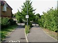
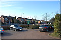


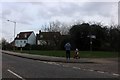
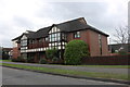
34 photos from this area
Area Information
Key information about the RM16 5UR including its size, population, and administrative classification.
- Area Type
- Postcode
- Area Size
- 2.8 hectares
- Population
- 1547
- Population Density
- 1064 people/km²
House Prices in RM16 5UR
16
Properties
£291,083
Average Sold Price
£228,000
Lowest Price
£472,000
Highest Price
Showing 16 properties
| Address | Type | Beds | Baths | Last Sale Price | Last Sale Date | |
|---|---|---|---|---|---|---|
| Brockhurst Villa, Clockhouse Lane, North Stifford, Grays, RM16 5UR | Semi-detached | 4 | 2 | £472,000 | Jul 2020 | |
| Barnhaven, Clockhouse Lane, North Stifford, Grays, RM16 5UR | Detached | 3 | 1 | £295,000 | Oct 2018 | |
| 47 Clockhouse Lane, North Stifford, Grays, RM16 5UR | house | - | - | £228,000 | Oct 2013 | |
| Havilah, Clockhouse Lane, North Stifford, Grays, RM16 5UR | house | - | - | £266,000 | Jun 2013 | |
| Wivanee, Clockhouse Lane, North Stifford, Grays, RM16 5UR | house | - | - | £238,000 | Apr 2011 | |
| Doone Cottage, Clockhouse Lane, North Stifford, Grays, RM16 5UR | Detached | - | - | £247,500 | Jul 2006 | |
| 43 Clockhouse Lane, North Stifford, Grays, RM16 5UR | Semi-detached | 3 | 1 | - | - | |
| Pambriars, Clockhouse Lane, North Stifford, Grays, RM16 5UR | Bungalow | 3 | 1 | - | - | |
| Graham Lodge, Clockhouse Lane, North Stifford, Grays, RM16 5UR | Bungalow | 3 | 1 | - | - | |
| 39 Clockhouse Lane, North Stifford, Grays, RM16 5UR | Bungalow | 3 | 1 | - | - |
Page 1 of 2
Energy Efficiency in RM16 5UR
Amenities
Schools
| Rank | School | Type | Entry gender | Ages |
|---|
Explore more schools in this area
Go to Schools tabDemographics
Household Size
Family (3-5 people)
most common
Accommodation Type
Houses
most common
Tenure
78
majority
Ethnic Group
White
most common
Religion
N/A
most common
Household Composition
N/A
most common
Age
47
median
Adults (30-64 years)
most common
Household Deprivation
N/A
with no deprivation
NS-SEC
38
in Lower managerial occupations
Explore more demographic insights in this area
Go to Demographics tabPlanning
Planning Constraints
- Flood RiskPremium
- Ramsar Wetland SitesPremium
- Area of Outstanding Natural BeautyPremium
- Protected Nature ReservePremium
- Protected WoodlandPremium