Area Overview for RM16 5UG
Photos of RM16 5UG
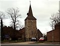
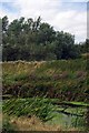
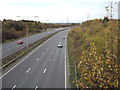
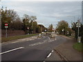
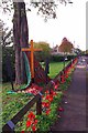
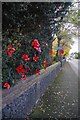
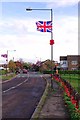
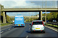
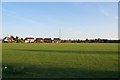
76 photos from this area
Area Information
Key information about the RM16 5UG including its size, population, and administrative classification.
- Area Type
- Postcode
- Area Size
- 3.2 hectares
- Population
- 1547
- Population Density
- 1064 people/km²
House Prices in RM16 5UG
9
Properties
£365,500
Average Sold Price
£177,500
Lowest Price
£620,000
Highest Price
Showing 9 properties
| Address | Type | Beds | Baths | Last Sale Price | Last Sale Date | |
|---|---|---|---|---|---|---|
| Old Post Cottage, High Road, North Stifford, Grays, RM16 5UG | Terraced | - | - | £325,000 | Nov 2020 | |
| Middlecot, High Road, North Stifford, Grays, RM16 5UG | Cottage | 1 | - | £195,000 | Aug 2020 | |
| 48 High Road, North Stifford, Grays, RM16 5UG | Detached | 4 | 1 | £620,000 | Aug 2020 | |
| 50 High Road, North Stifford, Grays, RM16 5UG | Detached | 3 | 1 | £510,000 | Jan 2016 | |
| Laburnum Cottage, High Road, North Stifford, Grays, RM16 5UG | Cottage | 1 | 1 | £177,500 | Dec 2013 | |
| 52 High Road, North Stifford, Grays, RM16 5UG | Detached | 3 | 2 | - | - | |
| 64 High Road, North Stifford, Grays, RM16 5UG | Detached | 3 | 2 | - | - | |
| 62 High Road, North Stifford, Grays, RM16 5UG | Detached | - | - | - | - | |
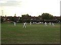
| The Cricket Green, High Road, North Stifford, Grays, RM16 5UG | Leisure | - | - | - | - |
Energy Efficiency in RM16 5UG
Amenities
Schools
| Rank | School | Type | Entry gender | Ages |
|---|
Explore more schools in this area
Go to Schools tabDemographics
Household Size
Family (3-5 people)
most common
Accommodation Type
Houses
most common
Tenure
78
majority
Ethnic Group
White
most common
Religion
N/A
most common
Household Composition
N/A
most common
Age
47
median
Adults (30-64 years)
most common
Household Deprivation
N/A
with no deprivation
NS-SEC
38
in Lower managerial occupations
Explore more demographic insights in this area
Go to Demographics tabPlanning
Planning Constraints
- Flood RiskPremium
- Ramsar Wetland SitesPremium
- Area of Outstanding Natural BeautyPremium
- Protected Nature ReservePremium
- Protected WoodlandPremium