Area Overview for RM16 3BH
Photos of RM16 3BH
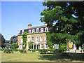
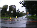
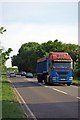
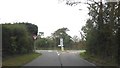
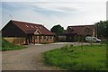
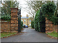
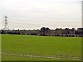
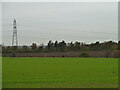
19 photos from this area
Area Information
Key information about the RM16 3BH including its size, population, and administrative classification.
- Area Type
- Postcode
- Area Size
- 30.8 hectares
- Population
- 1473
- Population Density
- 190 people/km²
House Prices in RM16 3BH
8
Properties
£506,667
Average Sold Price
£350,000
Lowest Price
£750,000
Highest Price
Showing 8 properties
| Address | Type | Beds | Baths | Last Sale Price | Last Sale Date | |
|---|---|---|---|---|---|---|
| The Orsett Fruit Farm, Orsett Road, Horndon On The Hill, RM16 3BH | Detached | 4 | 2 | £750,000 | Dec 2020 | |
| Hill View, Orsett Road, Horndon On The Hill, RM16 3BH | Semi-detached | 3 | 1 | £420,000 | Jul 2016 | |
| 2, Fruit Farm Cottage, Orsett Road, Horndon On The Hill, RM16 3BH | Semi-detached | 3 | - | £350,000 | Oct 2013 | |
| South Essex Wildlife Hospital, Orsett Road, Horndon On The Hill, RM16 3BH | commercial | - | - | - | - | |
| Rightway Electrical, Unit E First Floor, Orsett Fruit Farm, Orsett Road, Horndon On The Hill, RM16 3BH | Office | - | - | - | - | |
| Hawk Systems, Unit E Ground Floor, Orsett Fruit Farm, Orsett Road, Horndon On The Hill, RM16 3BH | Office | - | - | - | - | |
| Warden Accomodation, South Essex Wildlife Hospital, Orsett Road, Horndon On The Hill, RM16 3BH | Flat | - | - | - | - | |
| Lyndfield, Orsett Road, Horndon On The Hill, RM16 3BH | Detached | - | - | - | - |
Energy Efficiency in RM16 3BH
Amenities
Schools
| Rank | School | Type | Entry gender | Ages |
|---|
Explore more schools in this area
Go to Schools tabDemographics
Household Size
Family (3-5 people)
most common
Accommodation Type
Houses
most common
Tenure
86
majority
Ethnic Group
White
most common
Religion
N/A
most common
Household Composition
N/A
most common
Age
47
median
Adults (30-64 years)
most common
Household Deprivation
N/A
with no deprivation
NS-SEC
37
in Lower managerial occupations
Explore more demographic insights in this area
Go to Demographics tabPlanning
Planning Constraints
- Flood RiskPremium
- Ramsar Wetland SitesPremium
- Area of Outstanding Natural BeautyPremium
- Protected Nature ReservePremium
- Protected WoodlandPremium