Area Overview for RM16 2GN
Photos of RM16 2GN
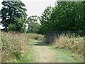
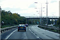
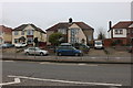
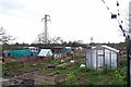

46 photos from this area
Area Information
Key information about the RM16 2GN including its size, population, and administrative classification.
- Area Type
- Postcode
- Area Size
- 1.6 hectares
- Population
- 2626
- Population Density
- 2886 people/km²
House Prices in RM16 2GN
41
Properties
£252,531
Average Sold Price
£66,500
Lowest Price
£795,000
Highest Price
Showing 41 properties
| Address | Type | Beds | Baths | Last Sale Price | Last Sale Date | |
|---|---|---|---|---|---|---|
| 63 Gordon Road, Grays, RM16 2GN | Bungalow | 2 | 1 | £345,000 | Sep 2025 | |
| 1 Gordon Road, Grays, RM16 2GN | Bungalow | 5 | 2 | £795,000 | May 2024 | |
| 71 Gordon Road, Grays, RM16 2GN | Bungalow | 2 | 1 | £370,000 | May 2021 | |
| 77 Gordon Road, Grays, RM16 2GN | house | - | - | £425,000 | Feb 2021 | |
| 31 Gordon Road, Grays, RM16 2GN | Semi-detached | 4 | 2 | £442,000 | Jun 2019 | |
| 7 Gordon Road, Grays, RM16 2GN | Semi-detached | 2 | 1 | £325,000 | Sep 2018 | |
| 21 Gordon Road, Grays, RM16 2GN | Bungalow | 3 | 1 | £275,000 | Dec 2015 | |
| 3 Gordon Road, Grays, RM16 2GN | Semi-detached | 2 | 2 | £310,000 | Sep 2014 | |
| 9 Gordon Road, Grays, RM16 2GN | Semi-detached | 3 | 2 | £270,000 | Dec 2012 | |
| 27 Gordon Road, Grays, RM16 2GN | Detached | - | - | £275,000 | Jul 2011 |
Page 1 of 5
Energy Efficiency in RM16 2GN
Amenities
Schools
| Rank | School | Type | Entry gender | Ages |
|---|
Explore more schools in this area
Go to Schools tabDemographics
Household Size
Family (3-5 people)
most common
Accommodation Type
Houses
most common
Tenure
89
majority
Ethnic Group
White
most common
Religion
N/A
most common
Household Composition
N/A
most common
Age
47
median
Adults (30-64 years)
most common
Household Deprivation
N/A
with no deprivation
NS-SEC
36
in Lower managerial occupations
Explore more demographic insights in this area
Go to Demographics tabPlanning
Planning Constraints
- Flood RiskPremium
- Ramsar Wetland SitesPremium
- Area of Outstanding Natural BeautyPremium
- Protected Nature ReservePremium
- Protected WoodlandPremium