Area Overview for RM16 1PD
Photos of RM16 1PD


Area Information
Powerhouse Plaza in RM16 1PD comprises a specific residential cluster that forms part of the wider Thurrock landscape. You are looking at a postcode covering exactly one thousand eight hundred and thirty-two residents within a relatively compact footprint. The area sits within Tendring and Tendring Parishes, offering a mix of settled housing and local convenience. Living in RM16 1PD means engaging with a community defined by its proximity to major distributions networks rather than a traditional high street focal point. The population density registers at two hundred and forty-eight people per square kilometre, indicating a settled residential footprint without the intense congestion of the city centre. This small postcode grouping offers a quiet environment where daily life revolves around practical access to nearby transport links and shopping hubs. Homes here benefit from a stable local demographic, and the area avoids significant planning constraints like protected woodlands or wetland sites. You can expect a straightforward residential experience where the boundary between the immediate neighbourhood and the wider commuter belt is minimal. The area functions as a practical living base for those who prioritise access over local village character.
- Area Type
- Postcode
- Area Size
- Not available
- Population
- 1832
- Population Density
- 248 people/km²
The property market in RM16 1PD is defined by a clear preference for owned accommodation and family-sized homes. A two-thirds majority of residents own their homes, meaning the area is characterised by owner-occupiers rather than a transient rental market. This statistic of sixty-six per cent ownership generally indicates property values that have held steady over time due to resident investment. The accommodation type is exclusively houses, which contrasts sharply with high-density flats found in other parts of London or Greater London. For buyers looking at homes in RM16 1PD, you are entering a market dominated by detached or semi-detached properties suited to the older demographic profile. This structural makeup means that major new build developments are unlikely to dominate the landscape in the immediate future. The housing stock reflects the needs of families and mature individuals who have remained in the area for years. If you are seeking a rental property, you may find limited stock relative to the total housing inventory. The market behaviour here is more akin to established suburbs than dynamic commuter villages with high vacancy rates.
House Prices in RM16 1PD
No properties found in this postcode.
Energy Efficiency in RM16 1PD
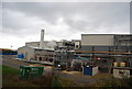
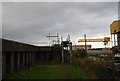
Daily life in RM16 1PD revolve around a practical network of amenities located within minutes of your door. Five localised retail and transport venues are within easy reach, ensuring you do not need to travel far for essentials. Retail options include M&S Thurrock, Iceland Thurrock, and Lidl Lakeside, providing convenient access to groceries and general merchandise. You have access to three ferry terminals including Tilbury Ferry Terminal and Town Pier, which serve cross-river journeys. These water-based links connect you to destinations on the opposite bank without the need for a car. Leisure and transport nodes include five railway stations and four metro stations like Elm Park Station, offering diverse route choices through Greater London. While parks and specific dining venues are not explicitly listed in the available data, the concentration of retail and transport hubs creates a convenient lifestyle for residents who prioritise accessibility over proximity to green spaces. Living in RM16 1PD means your daily errands are handled efficiently by the surrounding infrastructure. The area functions as a residential satellite with its own immediate shopping stops and transport interchanges.
Amenities
Schools
Education options for children living in RM16 1PD centre around one academy and one sixth-form college, both situated nearby. Harris Academy Riverside stands as a local academy with a good Ofsted rating. This provides a solid educational option for younger children before they progress to sixth form. The National College for the Creative and Cultural Industries operates as a sixth-form facility, offering a different academic pathway for older students in the area. This mix of school types means that primary and secondary education are accessible within the immediate vicinity, reducing the need for long commutes to schools further away. You do not have access to a full spectrum of infant, junior, and secondary schools directly within the postcode boundaries, but the nearby Harris Academy provides a recognised standard for general education. The presence of a creative arts sixth-form college adds variety to the local educational landscape. Families moving to RM16 1PD benefit from having established institutions close by that have already undergone regulatory inspection. While the selection is intuitive based on what is listed, these two named establishments cover the key stages of schooling needed for growing children.
| Rank | School | Type | Entry gender | Ages |
|---|
Explore more schools in this area
Go to Schools tabDemographics
The community in RM16 1PD is marked by a mature age profile and a high level of residential stability. The median age for residents is forty-seven years, and adults between thirty and sixty-four years form the most common age range. This demographic skew suggests that families and established professionals dominate the local scene. Home ownership is particularly strong here, with sixty-six per cent of households owning their property. In an era of rising rental demand, this figure indicates a deeply established neighbourhood where people tend to settle long-term rather than move frequently. The accommodation type consists principally of houses, which aligns with the older demographic and the high owner-occupation rate. While the predominant ethnic group is White, the area reflects the broader diversity of the Thurrock region. There is no single income bracket defined, but the age distribution suggests a community where pensioners and middle-aged workers reside alongside their working-age children. When living in RM16 1PD, you join a group of residents who have likely chosen this location for its balance of space and accessibility, resulting in a quiet, neighbourhood-centric atmosphere.
Household Size
Accommodation Type
Tenure
Ethnic Group
Religion
Household Composition
Age
Household Deprivation
NS-SEC
Explore more demographic insights in this area
Go to Demographics tabPlanning
Planning Constraints
- Flood RiskPremium
- Ramsar Wetland SitesPremium
- Area of Outstanding Natural BeautyPremium
- Protected Nature ReservePremium
- Protected WoodlandPremium