Area Overview for RM15 6TE
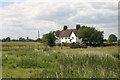
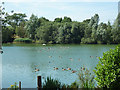
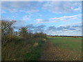
Photos of RM15 6TE


Area Information
Living in RM15 6TE means settling into a tightly clustered residential zone defined by its precise postcode. This specific area covers 5,364 square metres and hosts a small population of 1,439 residents. The density of 268,289 people per square kilometre indicates an intensely focused settlement rather than a sprawling suburb. You are looking at a defined community where daily life revolves close to a central point. The location is situated in England and functions as a distinct residential hub within the wider local authority framework. Prospective buyers should understand that they are purchasing a home within a very specific, geographically contained cluster. This small footprint creates a neighbourhood where services and neighbours are naturally proximate. The area lacks the sprawling nature of wider suburban districts because its physical boundaries are strict. You will find a homogeneous residential environment where the built-up space is limited to this postcode sector. The identity of RM15 6TE is rooted in its status as a contained residential unit rather than a mixed-use zone. Understanding this scarcity of land helps explain the character of the streets and the pace of daily movement.
- Area Type
- Postcode
- Area Size
- 5364 m²
- Population
- 1439
- Population Density
- 4496 people/km²
The property market in RM15 6TE is clearly dominated by owner-occupiers, with 83% of homes in the area held by their current owners. This high ownership rate means the market consists primarily of settled residents who have maintained their properties over time. The predominant accommodation type is houses, indicating that buyers will find detached or semi-detached dwellings rather than flats or high-rise apartments. This housing stock appeals to those seeking traditional domestic living with garden space and private outdoor areas. With such a high concentration of owner-occupied homes, the area functions as a established residential zone rather than a rental hotspot. Prospective buyers seeking small homes within this specific 5,364 square metre cluster will step into a market driven by stability and long-term possession. The nature of the accommodation suggests a preference for standalone living arrangements that suit families or couples. There is little evidence of speculative build or high-density development in this postcode. Instead, the value lies in the security of tenure and the quality of the physical properties themselves. Buyers should expect a market where prices reflect the value of established homes in a low-density, owner-focused environment.
House Prices in RM15 6TE
Showing 24 properties
| Address | Type | Beds | Baths | Last Sale Price | Last Sale Date | |
|---|---|---|---|---|---|---|
| 10 Magnolia Close, South Ockendon, RM15 6TE | Terraced | 2 | 1 | £330,000 | May 2024 | |
| 11 Magnolia Close, South Ockendon, RM15 6TE | Terraced | 3 | 1 | £418,000 | Sep 2023 | |
| 4 Magnolia Close, South Ockendon, RM15 6TE | Terraced | 2 | 1 | £355,000 | Oct 2022 | |
| 3 Magnolia Close, South Ockendon, RM15 6TE | house | - | - | £233,750 | Feb 2020 | |
| 26 Magnolia Close, South Ockendon, RM15 6TE | Terraced | 2 | - | £335,000 | Jun 2019 | |
| 24 Magnolia Close, South Ockendon, RM15 6TE | house | - | - | £307,500 | Mar 2019 | |
| 9 Magnolia Close, South Ockendon, RM15 6TE | house | - | - | £377,000 | Nov 2016 | |
| 13 Magnolia Close, South Ockendon, RM15 6TE | Terraced | 2 | 1 | £265,000 | Mar 2016 | |
| 6 Magnolia Close, South Ockendon, RM15 6TE | Semi-detached | 3 | - | £260,000 | Nov 2013 | |
| 7 Magnolia Close, South Ockendon, RM15 6TE | house | 2 | - | £177,000 | Jul 2013 |
Energy Efficiency in RM15 6TE
Your daily lifestyle in RM15 6TE benefits from a wide array of amenities within practical reach, despite the small physical size of the postcode. Local retail options include the Chelmsford Star Co-operative Society Co, Tesco South, and Lidl South, ensuring everyday shopping needs are easily met. Transportation links are robust with five nearby rail stations including Ockendon Railway Station, Chafford Hundred Railway Station, and Grays Railway Station offering regional train access. For commuters using metropolitan services, three metro stations such as Upminster Bridge, Hornchurch, and Elm Park Station provide direct tube connections to central London. Ferry options include Tilbury Ferry Terminal, West Street Pier, and Town Pier, adding diverse transport choices to your routine. These facilities create a convenient network where you do not need to travel far for essential services or commuting. The proximity of these named venues means grocery trips, train journeys, and public transport connections are short and frequent. You will find that this large range of transport and retail options clusters around your specific address in RM15 6TE.
Amenities
Schools
| Rank | School | Type | Entry gender | Ages |
|---|
Explore more schools in this area
Go to Schools tabDemographics
The community in RM15 6TE reflects a settled population with a median age of 47 years. Most residents are adults falling into the 30 to 64 years age bracket, suggesting a neighbourhood populated by families and established professionals. Eighty-three per cent of households own their homes, which points to a stable, owner-occupied community rather than a transient rental sector. The predominant accommodation type here is houses, consistent with the demographic profile of a mature residential area. White ethnicity forms the predominant group within this postcode cluster. This demographic mix creates a homogenous social environment typical of older suburban developments in England. The high rate of home ownership contributes to a sense of permanence among the local population.Residents are likely to be invested in the long term viability of their properties and the stability of the immediate surroundings. The age range indicates that children and young adults have already moved away, leaving a population focused on later life stages or young families who have established roots. This steady demographic profile supports a consistent demand for local family-friendly amenities and reliable community services.
Household Size
Accommodation Type
Tenure
Ethnic Group
Religion
Household Composition
Age
Household Deprivation
NS-SEC
Explore more demographic insights in this area
Go to Demographics tabPlanning
Planning Constraints
- Flood RiskPremium
- Ramsar Wetland SitesPremium
- Area of Outstanding Natural BeautyPremium
- Protected Nature ReservePremium
- Protected WoodlandPremium