Area Overview for RM15 4TE
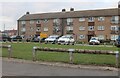
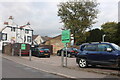
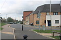
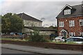
Photos of RM15 4TE


Area Information
Living in RM15 4TE offers a distinct experience defined by its specific postcode geography rather than a single renowned village name. This area covers a small residential cluster with a population of 1307 people, creating a tight-knit environment where neighbours know each other. The residential cluster sits with a population density of 1105 people per square kilometre, indicating a reasonably compact living arrangement compared to sprawling suburbs. You will find a neighbourhood that functions as a practical base for daily life, situated within the greater Thurock and Aveley corridor. This specific postcode serves as the administrative heart for a small group of homes, offering a quiet retreat from the more chaotic mainline stations nearby. Residents here balance a desire for local intimacy with close proximity to larger transport hubs like Purfleet and Ockendon. The area represents a focused residential option for those seeking a defined home territory without the anonymity of larger urban settlements. Everyday life revolves around this central cluster, providing a stable foundation for families or individuals looking to settle in a recognisable locality.
- Area Type
- Postcode
- Area Size
- Not available
- Population
- 1307
- Population Density
- 1105 people/km²
The property market in RM15 4TE is overwhelmingly defined by owner-occupation rather than the private rental sector. With 62 per cent of the population owning their homes, this figure signals a market where buyers purchase properties to remain in, rather than tenants moving on frequently. The primary accommodation type is houses, meaning you will find a stock of single-family dwellings rather than apartments or flats. This is a typical pattern for postcodes of this type, which cover a specific residential cluster rather than a dense urban high-rise zone. For buyers looking at this small area, the dominance of owner-occupied homes suggests higher stability and potentially stronger local enforcement of standards. The housing stock is geared towards families or individuals seeking a foothold in England's property market rather than quick turnover investment vehicles. Given that the area holds 1307 residents, the market is niche and specific to those targeting this particular postcode range. Homes in RM15 4TE cater to needs that prioritise space and established neighbourhoods over the extensive communal facilities found in larger developments.
House Prices in RM15 4TE
No properties found in this postcode.
Energy Efficiency in RM15 4TE
Daily life in RM15 4TE benefits from a network of amenities scattered just beyond the residential cluster boundaries. Retail options include five nearby locations, specifically the Co-op Aveley, Budgens Aveley, and M&S Thurrock M25 Moto SF, requiring a short drive to the main shopping corridors. For commuters, rail access is excellent with five stations within practical reach, including Purfleet Railway Station, Chafford Hundred Railway Station, and Ockendon Railway Station. If you prefer taking advantage of Thames Estuary travel, five metro and DLR stations connect you to Hornchurch, Upminster Bridge, and Elm Park Station. A ferry service adds further variety, with three terminals at Tilbury Ferry Terminal, West Street Pier, and Town Pier offering cross-channel routes. This mix of transport modes means you can choose how you travel every morning. Living in RM15 4TE means relying on these nearby hubs for your daily shopping, socialising, and commuting needs rather than having everything immediately on your doorstep. The area functions effectively as a residential dormitory because these specific venues provide comprehensive support.
Amenities
Schools
| Rank | School | Type | Entry gender | Ages |
|---|
Explore more schools in this area
Go to Schools tabDemographics
The community in RM15 4TE is characterised by an established demographic profile where the median age sits at 47 years. Most residents fall within the adult age range of 30 to 64 years, suggesting a neighbourhood dominated by mature households, families with older children, and empty nesters. This age profile indicates a stable community where long-term settlement is common rather than a transient rental hub. Regarding accommodation, the area primarily consists of houses, which aligns with the preference for detached or semi-detached living favoured by this age group. Home ownership stands at 62 per cent of the population, reinforcing the image of a settled area where individuals have invested in their local properties. The predominant ethnic group is White, reflecting the traditionally established character of this residential cluster. There are no indications of significant deprivation affecting the day-to-day quality of life for the majority of residents. The demographic consistency suggests a community focused on stability and continuity. You can expect a neighbourhood where residents have time, resources, and roots within this specific postcode area.
Household Size
Accommodation Type
Tenure
Ethnic Group
Religion
Household Composition
Age
Household Deprivation
NS-SEC
Explore more demographic insights in this area
Go to Demographics tabPlanning
Planning Constraints
- Flood RiskPremium
- Ramsar Wetland SitesPremium
- Area of Outstanding Natural BeautyPremium
- Protected Nature ReservePremium
- Protected WoodlandPremium