Area Overview for RM15 4RJ
Photos of RM15 4RJ
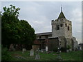
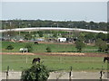

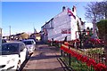
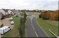
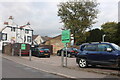
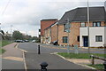
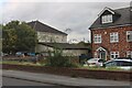
53 photos from this area
Area Information
Key information about the RM15 4RJ including its size, population, and administrative classification.
- Area Type
- Postcode
- Area Size
- 9384 m²
- Population
- 2360
- Population Density
- 4801 people/km²
House Prices in RM15 4RJ
21
Properties
£264,308
Average Sold Price
£50,000
Lowest Price
£390,000
Highest Price
Showing 21 properties
| Address | Type | Beds | Baths | Last Sale Price | Last Sale Date | |
|---|---|---|---|---|---|---|
| 56 Nethan Drive, Aveley, RM15 4RJ | Terraced | 3 | 1 | £340,000 | Aug 2025 | |
| 70 Nethan Drive, Aveley, RM15 4RJ | Terraced | 3 | 1 | £330,000 | Jul 2024 | |
| 44 Nethan Drive, Aveley, RM15 4RJ | Semi-detached | 3 | 1 | £390,000 | Jan 2023 | |
| 33 Nethan Drive, Aveley, RM15 4RJ | house | - | - | £385,000 | Dec 2021 | |
| 50 Nethan Drive, Aveley, RM15 4RJ | house | - | - | £272,000 | Jul 2020 | |
| 66 Nethan Drive, Aveley, RM15 4RJ | house | 4 | - | £366,000 | Aug 2019 | |
| 68 Nethan Drive, Aveley, RM15 4RJ | Terraced | 4 | 2 | £325,000 | Oct 2018 | |
| 23 Nethan Drive, Aveley, RM15 4RJ | house | 4 | - | £219,000 | Oct 2012 | |
| 25 Nethan Drive, Aveley, RM15 4RJ | Terraced | - | - | £204,000 | Sep 2007 | |
| 46 Nethan Drive, Aveley, RM15 4RJ | Terraced | - | - | £192,500 | Mar 2007 |
Page 1 of 3
Energy Efficiency in RM15 4RJ
Amenities
Schools
| Rank | School | Type | Entry gender | Ages |
|---|
Explore more schools in this area
Go to Schools tabDemographics
Household Size
Family (3-5 people)
most common
Accommodation Type
Houses
most common
Tenure
65
majority
Ethnic Group
White
most common
Religion
N/A
most common
Household Composition
N/A
most common
Age
47
median
Adults (30-64 years)
most common
Household Deprivation
N/A
with no deprivation
NS-SEC
28
in Lower managerial occupations
Explore more demographic insights in this area
Go to Demographics tabPlanning
Planning Constraints
- Flood RiskPremium
- Ramsar Wetland SitesPremium
- Area of Outstanding Natural BeautyPremium
- Protected Nature ReservePremium
- Protected WoodlandPremium