Area Overview for RM15 4PX
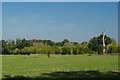
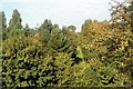
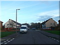
Photos of RM15 4PX


Area Information
RM15 4PX is a small residential cluster spanning 16.3 hectares, with a population of 1,631. You will live in a tightly knit neighbourhood where space is shared between homes and green areas. The area hosts 414 people per square kilometre, creating a settled environment free from the density of larger urban centres. Most residents own their properties, meaning the streetscape is dominated by stable, long-term homes rather than temporary rentals. The postcode area offers a quiet existence on the border between London and Essex, far from the congested rush of city life. Daily life here revolves around the familiar rhythm of a close community, where neighbours know each other well. You benefit from a layout that supports a calm pace of living while keeping essential services within a short drive or tube journey away. This specific cluster provides a sanctuary for those who prioritise stability and a quieter routine over the frisson of a metropolitan setting.
- Area Type
- Postcode
- Area Size
- 16.3 hectares
- Population
- 1631
- Population Density
- 414 people/km²
Homes in RM15 4PX are primarily houses, creating a consistent street-facing property type. The market is heavily weighted towards ownership, with 67% of the total households holding title deeds to their dwellings. This high level of owner occupation means you face less competition from short-term renters or those simply testing the market. The housing stock reflects the maturity of the 47-year median age, suggesting a range of established family homes rather than new-build conversions. You are looking at an area where residents have put down deep roots, often resulting in well-maintained exteriors and gardens. Finding a property here requires patience, as stock changes slowly due to the long tenure of current owners. The 16.3-hectare boundary creates a limited supply of available properties, so prices may reflect the scarcity of individual plots. Buyers should expect a traditional market where the focus is on acquiring a piece of a stable community rather than an investment opportunity.
House Prices in RM15 4PX
Showing 3 properties
| Address | Type | Beds | Baths | Last Sale Price | Last Sale Date | |
|---|---|---|---|---|---|---|
| Teaching Pool, Belhus Park Leisure Complex, Belhus Park Lane, Aveley, RM15 4PX | Leisure | - | - | - | - | |
| Main Pool, Belhus Park Leisure Complex, Belhus Park Lane, Aveley, RM15 4PX | Leisure | - | - | - | - | |
| Belhus Park Golf And Country Park, Belhus Park Lane, Aveley, RM15 4PX | Leisure | - | - | - | - |
Energy Efficiency in RM15 4PX
Daily life in RM15 4PX benefits from a practical network of nearby amenities, all within a short radius. You have access to five retail outlets, including Budgens Aveley, the Co-op Aveley, and Tesco South Ockendon. These supermarkets provide everyday necessities without requiring a long journey into the town centre. For commuters, five rail stations are located close by, specifically Ockendon Railway Station, Chafford Hundred Railway Station, and Purfleet Railway Station. Travel options expand further with five nearby Metro stations, including Upminster Bridge, Hornchurch, and Elm Park Station. Those preferring water travel can choose from three ferry terminals located at Tilbury Ferry Terminal, West Street Pier, and Town Pier. This diversity of transport options means you rarely need a car to reach shops or work. Your local options are further supported by the convenience of these named venues, ensuring that routine errands are handled efficiently from your doorstep.
Amenities
Schools
Families in RM15 4PX have access to excellent educational facilities, specifically Kenningtons Primary Academy. This primary school holds an outstanding Ofsted rating, establishing it as a top-tier choice for local children. Kenningtons Primary School also operates within the immediate vicinity, providing a second option if there is demand during admission cycles. Having two primary institutions in close proximity means you have flexibility when registering children for reception, depending on catchment boundaries and current enrolment numbers. Both schools serve the local cluster, ensuring that education is a central focus for residents. You do not need to commute far to secure quality schooling for your children. The presence of a rated outstanding academy adds significant value to living in this area, as parents prioritise high academic standards when choosing a home.
| Rank | School | Type | Entry gender | Ages |
|---|
Explore more schools in this area
Go to Schools tabDemographics
The community in RM15 4PX is defined by a mature population with a median age of 47 years. The majority of residents fall into the 30 to 64-year age range, indicating a neighbourhood built around families and adults in their working years. Property records show that 67% of homes are owner-occupied, suggesting a high level of long-term commitment by those who live here. Houses form the predominant accommodation type, reinforcing the character of a established domestic setting. The demographic profile is predominantly White, reflecting the traditional nature of this specific postcode. You can expect a community where stability is the norm, with few young professionals just starting out or students passing through temporarily. The high ownership rate mirrors a desire for permanence found among most households in this section of the Sama. For those considering buying into this demographic, the area appeals to established adults seeking a predictable environment for raising children or enjoying retirement.
Household Size
Accommodation Type
Tenure
Ethnic Group
Religion
Household Composition
Age
Household Deprivation
NS-SEC
Explore more demographic insights in this area
Go to Demographics tabPlanning
Planning Constraints
- Flood RiskPremium
- Ramsar Wetland SitesPremium
- Area of Outstanding Natural BeautyPremium
- Protected Nature ReservePremium
- Protected WoodlandPremium