Area Overview for RM15 4DP
Photos of RM15 4DP
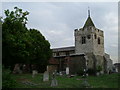
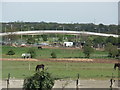

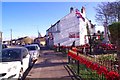
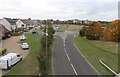
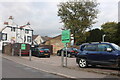
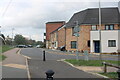
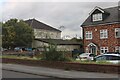
53 photos from this area
Area Information
Key information about the RM15 4DP including its size, population, and administrative classification.
- Area Type
- Postcode
- Area Size
- 9151 m²
- Population
- 1596
- Population Density
- 3730 people/km²
House Prices in RM15 4DP
25
Properties
£253,273
Average Sold Price
£26,000
Lowest Price
£362,000
Highest Price
Showing 25 properties
| Address | Type | Beds | Baths | Last Sale Price | Last Sale Date | |
|---|---|---|---|---|---|---|
| 54 Purfleet Road, Aveley, RM15 4DP | Semi-detached | 2 | 1 | £362,000 | Jun 2023 | |
| 50A Purfleet Road, Aveley, RM15 4DP | Semi-detached | 2 | 1 | £325,000 | Feb 2023 | |
| 62 Purfleet Road, Aveley, RM15 4DP | Flat | - | - | £26,000 | Mar 2020 | |
| 58 Purfleet Road, Aveley, RM15 4DP | Detached | 2 | 1 | £350,000 | Aug 2017 | |
| 31 Purfleet Road, Aveley, RM15 4DP | Semi-detached | 3 | 1 | £275,000 | Jan 2016 | |
| 52 Purfleet Road, Aveley, RM15 4DP | house | 4 | - | £285,000 | May 2011 | |
| 39 Purfleet Road, Aveley, RM15 4DP | house | - | - | £293,000 | May 2010 | |
| 60 Purfleet Road, Aveley, RM15 4DP | house | - | - | £225,000 | Mar 2008 | |
| 37 Purfleet Road, Aveley, RM15 4DP | Semi-detached | - | - | £230,000 | Feb 2006 | |
| 56 Purfleet Road, Aveley, RM15 4DP | Semi-detached | - | - | £125,000 | Nov 2002 |
Page 1 of 3
Energy Efficiency in RM15 4DP
Amenities
Schools
| Rank | School | Type | Entry gender | Ages |
|---|
Explore more schools in this area
Go to Schools tabDemographics
Household Size
Family (3-5 people)
most common
Accommodation Type
Houses
most common
Tenure
49
majority
Ethnic Group
White
most common
Religion
N/A
most common
Household Composition
N/A
most common
Age
47
median
Adults (30-64 years)
most common
Household Deprivation
N/A
with no deprivation
NS-SEC
19
in Lower managerial occupations
Explore more demographic insights in this area
Go to Demographics tabPlanning
Planning Constraints
- Flood RiskPremium
- Ramsar Wetland SitesPremium
- Area of Outstanding Natural BeautyPremium
- Protected Nature ReservePremium
- Protected WoodlandPremium