Area Overview for RM14 3PJ
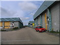
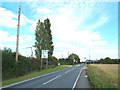
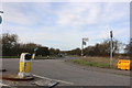
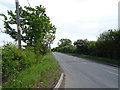
Photos of RM14 3PJ


Area Information
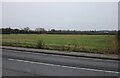
Living in RM14 3PJ offers a glimpse into a quiet residential cluster characterised by deep historical roots. This specific postcode covers 24 hectares within the Herongate, Ingrave, and West Horndon ward of the Brentwood District. The area sits on the A128 road, linking Brentwood and West Horndon just south of the M11 motorway. A population of 1,532 calls this small area home, creating a setting where neighbours often know one another. The settlement dates back to Anglo-Saxon times, with Ingrave deriving its name from the Gegingas district, while Herongate likely originates from the Heron family who held the local estate. Residents navigate a landscape dotted with historical remnants, including the medieval moated site of Heron Hall and the Grade II listed Boar's Head pub, which overlooks the village pond near Button Common. The architecture reflects centuries of history, featuring historic houses along Ingrave Common and Cricketers Lane. Some buildings predate the 17th century, offering substantial properties that stand alongside more modern constructions. Daily life here moves at a measured pace, far removed from the busy urban centres of London. You are surrounded by the greenery of Ingrave Common and the proximity to the railway line that runs through the surrounding villages. The area also contains no Ramsar wetland sites, protected nature reserves, or areas of outstanding natural beauty, which removes certain planning constraints for development while preserving the current character of the village.
- Area Type
- Postcode
- Area Size
- 24.0 hectares
- Population
- 1532
- Population Density
- 92 people/km²
The property market in RM14 3PJ is defined by a significant majority of owner-occupied residences. With 75% of homes owned outright or with a mortgage, this postcode functions primarily as an established residential market rather than a landlord-heavy rental zone. The accommodation type is almost exclusively houses, which is typical for villages situated on the A128 corridor between Brentwood and West Horndon. This ownership profile means you are likely to find stately homes, such as replacements for historic cottages or developments on former estates, rather than purpose-built apartment blocks. For buyers looking at this small area and its immediate surroundings, this presents a specific dynamic. The high home ownership rate indicates that properties here are often passed down or purchased for long-term living. This contrasts sharply with fragmented house prices commonly seen in student villages or commuter towns dominated by private rentals. The housing stock includes varied periods, from 18th-century cottages linked to the Petre family and Tyrell heirs to 19th-century constructions and modern expansions. Because the area is only 24 hectares, supply is naturally limited. If you are considering purchasing, expect competition to be driven by local families moving house rather than investors seeking short-term rental yields. The market reflects a desire for space and a connection to local history rather than urban convenience.
House Prices in RM14 3PJ
Showing 19 properties
Energy Efficiency in RM14 3PJ
Daily life in RM14 3PJ revolves around a handful of key amenities accessible within a short drive or walk. Retail needs are met by local outlets such as Morrisons Daily West and Tesco Cranham, both situated nearby for everyday shopping. For those seeking higher-end provisions, Waitrose is located at Upminster, a reasonable distance away. The area is also close to three major rail stations that facilitate access to work and leisure, with Upminster Bridge, Hornchurch, and Elm Park all offering convenient links. West Horndon Railway Station is another key node nearby. While the nearby scenery is domestic, the area retains pockets of its historic character. The Boar's Head pub, originally three Tudor cottages, stands as a social anchor overlooking the village pond near Button Common. The historic houses along Ingrave Common and Cricketers Lane provide visual interest and a walkable environment for evening strolls. The assault of city noise is kept at bay by the green buffers of common land. Life here is about proximity to essentials rather than abundance of entertainment. You will find plenty of space to live but limited modern leisure venues like cinemas or gyms, which require travel to larger towns. The lifestyle is active in terms of travel, given the reliance on the A128 and rail network, but calm within the village boundaries. This mix suits those who value access to roads and trains over having every facility on the doorstep.
Amenities
Schools
Families in RM14 3PJ have access to several educational institutions nearby, though the local authority maintains schools have been varied in their provision over the years. Woodlands School operates as an independent institution and serves the community alongside Ursuline Preparatory School, which also maintains independent status. These private and independent options provide families with alternatives to the state system, allowing for smaller class sizes and often different educational philosophies. For those seeking other types of education, Leverton PRU, Leverton Hall, and Leverton House are located in the vicinity. These facilities usually cater to primary education, special educational needs, or alternative learning pathways. The presence of a Provisional Unit (PRU) suggests some local sourcing for students requiring additional support. When choosing schools near RM14 3PJ, you must balance the prestige and flexibility of the independent sector with the availability of local state schools. The mix of options means parents are not locked into a single provider but can select environments that suit their children's needs. Note that specific Ofsted ratings for these institutions are not included in the available data, so independent research into current inspection reports is essential before applying. Regardless of the choice, these schools are situated within practical reach of the 24-hectare cluster, ensuring reasonable travel times for local children.
| Rank | School | Type | Entry gender | Ages |
|---|
Explore more schools in this area
Go to Schools tabDemographics
The community in RM14 3PJ is distinctively mature, with a median age of 47 years. Adults between the ages of 30 and 64 years represent the most common age range, indicating a population dominated by families with grown children and professionals in later stages of their careers. Home ownership stands at 75%, suggesting a long-term community where residents have built roots over many years. The overwhelming majority of homes are detached or semi-detached houses, rather than flats or apartments. This housing stock supports a demographic that values space and stability. While specific deprivation data is not included in the available statistics, the high rate of home ownership typically correlates with lower residential turnover. The predominant ethnic group is White, which aligns with the traditional character of the Essex villages that make up this ward. The age profile suggests this is an area established by families who sought refuge from larger towns and eventually aged in place. The low population density of 92 people per square kilometre reinforces this suburban feel. You will find fewer young professionals and students compared to areas closer to central London or major employment hubs. The demographic makeup creates a stable environment where local schools and community facilities cater primarily to families and working-age adults. The area lacks the transient feel often found in high-rental zones, as three-quarters of residents remain in their own homes.
Household Size
Accommodation Type
Tenure
Ethnic Group
Religion
Household Composition
Age
Household Deprivation
NS-SEC
Explore more demographic insights in this area
Go to Demographics tabPlanning
Planning Constraints
- Flood RiskPremium
- Ramsar Wetland SitesPremium
- Area of Outstanding Natural BeautyPremium
- Protected Nature ReservePremium
- Protected WoodlandPremium