Area Overview for Rivenhall
Photos of Rivenhall
Area Information
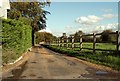
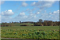
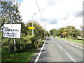
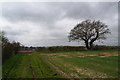
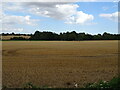
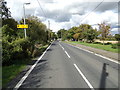
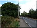
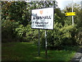
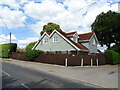
Living in Rivenhall means residing within a civil parish in the Braintree district of Essex, situated near Witham in Eastern England. The area covers a total of 9.2 km², offering a rural setting close to the A12 road and the Witham railway station. You can enjoy daily life in a location that has deep historical roots, having hosted a Roman villa and an Anglo-Saxon hall before becoming the home of Thomas Western, an iron-founder who built Rivenhall Place in 1692. The landscape also features St Mary and All Saints Church, a Grade I listed building that forms the heart of the community. Your postcode falls near townships including Rivenhall End, which sits alongside the surrounding countryside. The history of the area extends back significantly, with structures rebuilt in stone following Anglo-Saxon foundations. The parish saw significant changes in its administration, being abolished in 1933 and reformed in 1982, while the airfield that operated during World War II adds to the local heritage. Residents benefit from proximity to major infrastructure, making Rivenhall a distinct choice for those seeking a village life near transport links.
- Area Type
- Parish
- Area Size
- 9.2 km²
- Population
- Not available
- Population Density
- Not available
Demographics
The community in Rivenhall displays a distinct demographic profile characterised by an older population. The median age of residents is 70 years, indicating that the village is predominantly occupied by retirees and older generations. This age distribution shapes the local culture, from community activities to the pace of daily life. Home ownership stands at an impressive 79 per cent of all households, suggesting a community of long-term residents rather than a transient population. Accommodation types reflect this stability, with the majority of dwellings likely owned outright or with residual mortgages. You will find that the ethnic group breakdown, religious affiliations, and household composition data points are part of this settled demographic pattern. The high level of ownership means that most properties are sold rather than rented, which stabilises the local market. Deprivation levels are typically managed within this established neighbourhood, as the population consists of those with significant equity in their homes. This demographic reality defines the social fabric of Rivenhall, creating a quiet environment where neighbours have known each other for decades.
Household Size
Accommodation Type
Tenure
Ethnic Group
Religion
Household Composition
Age
Household Deprivation
NS-SEC
Explore more demographic insights in this area
Go to Demographics tabPlanning
Planning Constraints
- Flood RiskPremium
- Ramsar Wetland SitesPremium
- Area of Outstanding Natural BeautyPremium
- Protected Nature ReservePremium
- Protected WoodlandPremium
- Crime RiskPremium