Area Overview for Riseley
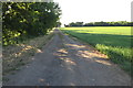
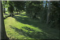
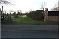
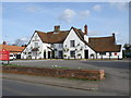
Photos of Riseley

Area Information
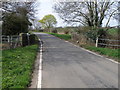
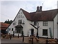
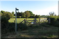
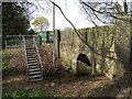
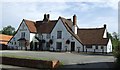
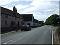
Riseley is a civil parish situated nine miles north of Bedford in Bedfordshire, covering an area of 12.5 km². You will find the village defined as an ancient parish surrounded by Melchbourne, Swineshead and Keysoe, with a recorded population of 1284. The High Street stretches for a mile and retains the character of a former turnpike road designated in 1802, complete with a historic Tollbar Corner. Your daily life here feels removed from major motorways, as there are no current railway stations or direct access to A-roads within the immediate vicinity. Instead, the layout is peaceful, featuring a single watercourse tributary to the River Ouse that flows through the landscape. History permeates the surroundings, from the All Saints parish church with its roots in the 12th century to the remnants of cottage industries that once drove the local economy. Brickmaking flourished from 1558, and lace-making occupied 80 of the 118 houses in 1851. You walk past redundant chapels on High Street, built for Methodist, Moravian, and Baptist congregations in the 19th century, alongside a war memorial erected in 1920. Coppice Wood marks a significant point in the area's recent history, having served as a mustard gas storage site from 1939 to 1945 before being cleared in 1988. Living in Riseley means embracing a setting where you are close to Bedford but retain the quiet atmosphere of a long-established village in the Stodden Hundred.
- Area Type
- District Borough Unitary Ward
- Area Size
- 12.5 km²
- Population
- Not available
- Population Density
- Not available
Demographics
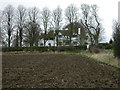
The community in Riseley is defined by a settled population with a median age of 70 years. Most residents fall within the older age brackets, reflecting the village's status as a traditional retirement location. You will find that 81% of households are owned outright or have a mortgage, indicating a strong preference for ownership over renting. The low tenant population suggests stability, as long-term residents remain in their properties. There is no recent data available on the specific breakdown of household composition or predominant ethnic groups, but the age profile clearly points to a mature demographic. This high level of home ownership creates a static and established neighbourhood. Families with young children may find fewer peers compared to areas with a younger age distribution, as the most common age range skews significantly higher. You are buying into a community where neighbours have likely lived in their homes for decades. The lack of rental proportions means you are dealing primarily with motivated owners rather than transient occupants. While specific figures on deprivation indices were not provided in the local analysis, the demographic stability of 81% ownership suggests a consistent community fabric. Your social interactions will likely centre on existing local clubs or the parish council, which manages the civil parish affairs. The settlement remains a quiet haven where the residents are predominantly senior citizens enjoying their retirement years.
Household Size
Accommodation Type
Tenure
Ethnic Group
Religion
Household Composition
Age
Household Deprivation
NS-SEC
Explore more demographic insights in this area
Go to Demographics tabPlanning
Planning Constraints
- Flood RiskPremium
- Ramsar Wetland SitesPremium
- Area of Outstanding Natural BeautyPremium
- Protected Nature ReservePremium
- Protected WoodlandPremium
- Crime RiskPremium