Area Overview for Ringshall
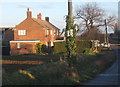
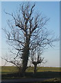
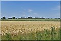
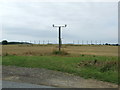
Photos of Ringshall


Area Information
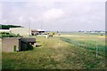
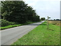
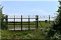
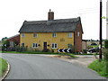
Living in Ringshall offers a quiet life within a small agricultural parish in the Mid Suffolk district. This civil parish covers an area size of 8.6 km², hosting homes that are spread out rather than clustered in a dense urban centre. You will find yourself in rural mid-Suffolk, positioned around four miles south of Stowmarket and 13 miles north-west of Ipswich. The village character is defined by its working estates, including farms and houses scattered across the landscape. Historically significant sites ground the community, such as the Church of St Catherine on Stowmarket Road, which features a Norman tower, and the Grade II listed moated Ringshall Grange. Nearby Wattisham Airfield adds to the local interest, having served as a US base during the Second World War. The postcode for the area is Stowmarket (IP14) with a dialling code of 01473. While there are no detailed railway journey times provided for major cities, the nearest train station is Needham Market, located 3¼ miles west-south-west of the village. Daily life here revolves around a rural pace, with the church and grange serving as focal points for a population deeply rooted in the land.
- Area Type
- Parish
- Area Size
- 8.6 km²
- Population
- Not available
- Population Density
- Not available
Demographics
The community in Ringshall is defined by an older population profile. The median age stands at 70, making this one of the areas with the highest average ages in the country. The most common age range recorded is simply Age: Total, reflecting the concentration of elderly residents rather than young families or working-age adults. Regarding household composition, data confirms the village comprises a total household count, though specific breakdowns of singles, couples, or families are not itemised in the statistics. Home ownership is a defining feature, with 53% of residents owning their property outright or with a mortgage. This suggests a significant portion of the population consists of retirees who have settled permanently in the village. Accommodation types follow a similar pattern, showing a total record for the parish without further subdivision into detached, semi-detached, or terraced housing. The area does not display specific figures for ethnic diversity or religious affiliation within the provided demographic records. For someone seeking homes in Ringshall, this static demographic indicates a stable, established community rather than a rapidly growing or transient neighbourhood.
Household Size
Accommodation Type
Tenure
Ethnic Group
Religion
Household Composition
Age
Household Deprivation
NS-SEC
Explore more demographic insights in this area
Go to Demographics tabPlanning
Planning Constraints
- Flood RiskPremium
- Ramsar Wetland SitesPremium
- Area of Outstanding Natural BeautyPremium
- Protected Nature ReservePremium
- Protected WoodlandPremium
- Crime RiskPremium