Area Overview for Rickinghall Superior
Photos of Rickinghall Superior
Area Information
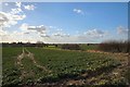
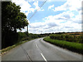
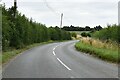
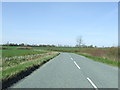
Rickinghall Superior is a civil parish located in England, covering an area of 5.7 km². This small locality offers a defined sense of place for those seeking a settled community. The area functions as a self-contained unit where residents live close to their daily surroundings. You will find that the layout supports a slower pace of life compared to major urban centres. The total land size means that green space is likely close to your new home. The parish provides a clear geographical boundary for your commute and daily walks. Living in Rickinghall Superior appeals to you if you value a contained environment. The community size indicates a neighbourhood where local interactions can thrive. You can expect a setting that prioritises stability over rapid development. The physical dimensions of the parish shape the character of the streets and gardens. This distinction matters when you compare it to larger towns or cities. The area maintains its identity as a specific living space. Every home here exists within these clear limits. The definition of the parish helps you understand the scope of your immediate surroundings. You know exactly where you are when you stand in Rickinghall Superior.
- Area Type
- Parish
- Area Size
- 5.7 km²
- Population
- Not available
- Population Density
- Not available
Demographics
The population of Rickinghall Superior displays a notable age profile with a median age of 70. This statistic indicates that the community consists primarily of older residents. The most common age range data is recorded as 'Total', suggesting you should look at the overall composition rather than specific youth or elderly clusters. High home ownership levels define the financial status of the neighbourhood. Seventy-seven per cent of households own their homes, which is a significant majority. This figure suggests a stable tenant base with deep local roots. You will find that rental properties constitute a small fraction of the total housing stock. The household composition data notes the total count, reinforcing the picture of established families or individuals. The accommodation type statistics reflect this long-term tenure pattern. Predominant ethnic group information is recorded for the total population, ensuring you have a complete picture of diversity. Religious affiliation data is also available for the total community, offering insight into local traditions. Deprivation is not highlighted in the provided metrics, but the high ownership rate often correlates with financial stability. When you consider moving here, you are joining a group where residents are likely to spend their lives in the same property. The demographic facts paint a clear portrait of an ageing, owner-occupied population.
Household Size
Accommodation Type
Tenure
Ethnic Group
Religion
Household Composition
Age
Household Deprivation
NS-SEC
Explore more demographic insights in this area
Go to Demographics tabPlanning
Planning Constraints
- Flood RiskPremium
- Ramsar Wetland SitesPremium
- Area of Outstanding Natural BeautyPremium
- Protected Nature ReservePremium
- Protected WoodlandPremium
- Crime RiskPremium