Area Overview for Rickinghall Inferior
Photos of Rickinghall Inferior
Area Information
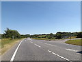
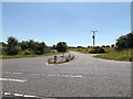
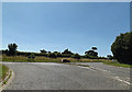
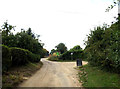
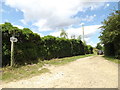
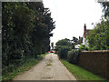
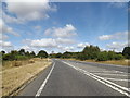
Rickinghall Inferior stands as a distinct civil parish covering an area of just 8.0 km² within the wider Essex landscape. This small footprint defines a neighbourhood where residents live in close proximity to one another, fostering a community atmosphere rooted in local ties rather than urban sprawl. The compact size means daily journeys are short, allowing inhabitants to manage their week within the bounds of the parish or by travelling a few miles to nearby villages like Rickinghall Superior for additional services. Living in Rickinghall Inferior offers a straightforward homebuying experience, as the geographic limits are clear and the boundaries contain a specific mix of rural and residential settings. The parish provides a manageable scale for those who prefer a defined community over the anonymity of larger towns. You will find that the area maintains a clear identity, separate from its neighbour but connected through shared local history and geography. The physical size of the parish ensures that no resident is far from the edge of their settlement, which often simplifies navigation and access to open spaces. This clarity in boundaries and scale makes planning a move to Rickinghall Inferior a practical decision based on real geographic facts rather than vague descriptions of potential.
- Area Type
- Parish
- Area Size
- 8.0 km²
- Population
- Not available
- Population Density
- Not available
Demographics
The community within Rickinghall Inferior reflects a demographic profile typical of established coastal and rural parishes. The median age for residents stands at 70 years, indicating that the parish is dominated by older age groups. This age skew suggests that the typical household involves retirees or those who have spent decades living in the area. While the specific distribution across age bands is not detailed, the median figure highlights a population that values stability and quiet surroundings. Home ownership rates are exceptionally high, reaching 75 per cent of all households. This significant majority indicates that the homes in Rickinghall Inferior are primarily owned by those who live in them, rather than being part of the rental sector. Household composition and predominant ethnic group data are aggregated in the total, reinforcing the idea of a settled, long-term population. The high level of ownership correlates with the older demographic, as many residents have built their lives in the parish over many years. For a prospective buyer, this means entering a market characterised by permanence and local continuity. The lack of transient populations often leads to a stronger sense of neighbourhood belonging and established local routines that define daily life for the people of Rickinghall Inferior.
Household Size
Accommodation Type
Tenure
Ethnic Group
Religion
Household Composition
Age
Household Deprivation
NS-SEC
Explore more demographic insights in this area
Go to Demographics tabPlanning
Planning Constraints
- Flood RiskLocked
- Ramsar Wetland SitesLocked
- Area of Outstanding Natural BeautyLocked
- Protected Nature ReserveLocked
- Protected WoodlandLocked
- Crime RiskLocked