Area Overview for Reydon
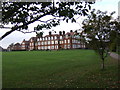
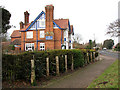
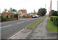
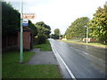
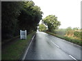
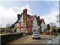
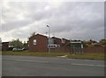
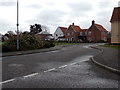
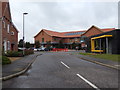
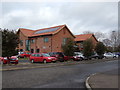
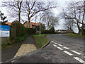
Photos of Reydon
Area Information
Reydon is a compact built-up area in England, covering 1.0 km². It is home to a population with a median age of 70, suggesting a community skewed towards older residents. The area’s proximity to Southwold and Walberswick offers access to coastal amenities, with ferries to Walberswick and Southwold providing easy travel options. Reydon’s character is defined by its proximity to retail hubs like Co-op Southwold and Tesco Southwold, which cater to daily needs. The area’s schools, including Reydon Primary and High School, are central to family life. Living here means a slower pace, with a focus on local amenities and community ties. The home ownership rate of 73% indicates a stable housing market, though the specific types of accommodation are not detailed. Reydon’s appeal lies in its quiet, well-connected nature, blending coastal access with practical living. For buyers seeking a low-crime, established area with nearby services, Reydon offers a distinct blend of convenience and tranquillity.
- Area Type
- Built Up Area 250
- Area Size
- 1.0 km²
- Population
- Not available
- Population Density
- Not available
Residents of Reydon have access to five retail venues, including Co-op Southwold and Tesco Southwold, providing essential shopping and dining options. The area’s ferry landings at Southwold and Walberswick offer direct access to coastal travel, enhancing connectivity to nearby towns. While the data does not specify parks or leisure facilities, the presence of schools and retail hubs suggests a focus on practical daily needs. The community’s lifestyle appears to prioritise convenience and proximity to services over expansive recreational spaces. The combination of local shops and ferry access supports a self-contained lifestyle, though residents may need to travel further for more diverse leisure options. Overall, Reydon’s amenities cater to a mature population with straightforward, reliable access to essentials.
Amenities
Schools
Reydon is served by two primary schools: Reydon Primary School and Reydon High School, both offering primary education. One of the primary schools has an Ofsted rating of ‘good’, indicating a standard of education that meets expectations. The presence of two primary schools suggests a focus on early education, though secondary schooling options are not detailed. Families with young children may benefit from the proximity of these schools, though the absence of secondary education facilities could influence long-term planning. The ‘good’ rating at one school provides a benchmark for quality, but buyers should verify current performance and availability of places. The mix of schools reflects a community prioritising foundational education, with potential gaps in higher-level academic provision.
| Rank | School | Type | Entry gender | Ages |
|---|
Explore more schools in this area
Go to Schools tabDemographics
Reydon’s population has a median age of 70, the highest recorded in the dataset, indicating a predominantly older demographic. Home ownership stands at 73%, reflecting a strong presence of owner-occupied properties. The data does not specify household composition or accommodation types, but the overall figures suggest a mature community with established residents. The absence of detailed diversity metrics means the area’s ethnic and religious composition remains unspecified. However, the high median age may imply a population with fewer young families, which could influence local services and amenities. For quality of life, the low crime risk and access to nearby schools and shops suggest a stable environment, though the age profile may affect the vibrancy of social and cultural activities.
Household Size
Accommodation Type
Tenure
Ethnic Group
Religion
Household Composition
Age
Household Deprivation
NS-SEC
Explore more demographic insights in this area
Go to Demographics tabPlanning
Planning Constraints
- Crime RiskPremium