Area Overview for Renhold & Ravensden Ward
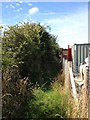
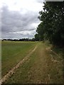
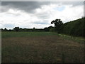
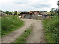
Photos of Renhold & Ravensden Ward
Area Information
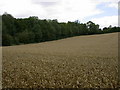
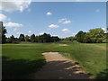
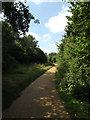
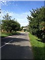
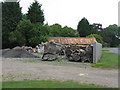
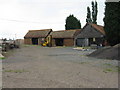
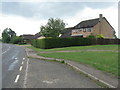
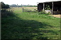
Renhold & Ravensden Ward offers a distinct rural living experience situated within Bedford Borough Council in Bedfordshire. This unitary authority ward spans 18.2 km² and is defined by its agricultural landscape and quiet village settlements. The area lies approximately at coordinates 52.171139, -0.423021, with borders touching the town of Bedford to the south. Residential life here centres on postcodes primarily found in the MK41 and MK44 ranges. You will find yourself surrounded by farmland rather than dense urban development, providing a escape from the faster pace of city life while maintaining access to local amenities. The ward encompasses two specific village communities: Renhold and Ravensden. Each settlement possesses its own character and local history. Ravensden stands out for its historical landmarks, including All Saints Church which dates back to the 12th century. This religious building features notable 16th-century additions that reflect the parish's long historical development. The area is not merely about open fields and ancient churches; it includes modern community infrastructure like Ravensden CofE Primary Academy and The Horse and Jockey pub. A village hall further supports local social activities. Living in Renhold & Ravensden Ward means choosing a location defined by tradition and rural tranquility. The established sense of community is rooted in these historic villages, yet the area has seen modern developments such as the Woodlands Park housing estate created in the late 2000s. This estate is located in southern Ravensden parish and is now part of Brickhill parish. Whether you seek the charm of a historic village centre or the quiet of a residential area within a rural setting, this ward delivers those specific qualities without the constraints of a town centre.
- Area Type
- District Borough Unitary Ward
- Area Size
- 18.2 km²
- Population
- Not available
- Population Density
- Not available
Demographics
The community profile of Renhold & Ravensden Ward suggests a settlement geared towards retirement and long-term stability. The median age for residents is 70 years old, making this one of the oldest demographic profiles in the region. When analysing living in Renhold & Ravensden Ward, you will find that age is the most common defining characteristic of the population. This high median age indicates a lack of young families and suggests a demographic shift away from traditional career-raising households. Home ownership is exceptionally high within this ward, with 74% of households owning their property outright or with a mortgage. This level of ownership aligns with the older population, as many homebuyers in their later years enjoy the security of no rental debt. The prevalence of owner-occupiers shapes the local dynamics and investment stability within the area. You can expect a community where residents have likely lived in their homes for decades, fostering deep local roots. Despite the specific data regarding household composition and predominant ethnic groups not being explicitly detailed in the provided statistics, the 74% home ownership rate is a concrete fact that defines the area's economic base. Rural wards like this often have specific housing stock limitations that reinforce high ownership rates among those who can secure mortgages earlier in life. The accommodation type data points to a structure dominated by residential dwellings typical of village life, rather than high-density blocks. This demographic reality means the local economy and services cater largely to retired couples and older individuals seeking a peaceful environment.
Household Size
Accommodation Type
Tenure
Ethnic Group
Religion
Household Composition
Age
Household Deprivation
NS-SEC
Explore more demographic insights in this area
Go to Demographics tabPlanning
Planning Constraints
- Flood RiskPremium
- Ramsar Wetland SitesPremium
- Area of Outstanding Natural BeautyPremium
- Protected Nature ReservePremium
- Protected WoodlandPremium
- Crime RiskPremium