Area Overview for Rendlesham & Orford Ward
Photos of Rendlesham & Orford Ward
Area Information
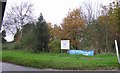
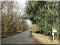
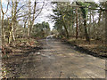
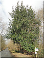
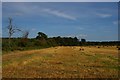
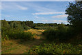
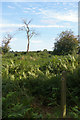
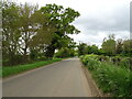
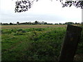
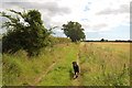
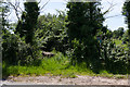
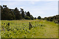
Living in Rendlesham & Orford Ward offers a life rooted in history within East Suffolk's rural landscape. This electoral ward spans 100.8 square kilometres and encompasses the civil parish of Rendlesham near Woodbridge, along with the area around Orford. You will find yourself in a setting that once served as a royal centre for the kings of the East Angles, where Bede recorded the governance and feasting of the 8th century. The ward's coordinates sit around 52.1229°N, 1.5029°E, placing you in a region defined by its quiet, village atmosphere. Current estimates place the population at 4,978 residents, though official ward statistics record a population of 1,744 people. This discrepancy reflects the difference between the wider parish community and the specific administrative boundary defined for local council wards. Daily life here moves at a slower pace, supported by extensive green spaces like Rendlesham Forest and proximity to the historic RAF Bentwaters airfield site. You are entering a community with deep roots, notable for figures such as historian Laurence Echard and tennis player Edith Austin. Your home will be surrounded by views that likely include parts of the Sandlings Forest, making this a choice for those seeking a break from urban congestion while maintaining a clear link to Suffolk's broader heritage.
- Area Type
- District Borough Unitary Ward
- Area Size
- 100.8 km²
- Population
- 1744
- Population Density
- 852 people/km²
Demographics
The community structure in Rendlesham & Orford Ward reflects a settled demographic with high levels of stability. Official figures show that 70% of residents own their homes, indicating a stable, owner-occupied market rather than a transient rental sector. The median age stands at 70 years, pointing towards an older population profile compared to many modern towns. While specific breakdowns for ethnicity and religion are not detailed in the current dataset, the broader local character suggests a predominantly White British community with a significant number of residents reporting no religious affiliation. Household composition data is available in the full profiles but not explicitly itemised in this summary view, so you must rely on the strong owner-occupancy rate to understand the dwelling types. You can expect a neighbourhood where long-term residents have established deep local connections. The general feel is quiet and safe, with an average age that often varies slightly between census years, recorded as 43.1 in 2021 for the wider parish. This age distribution suggests a need for family-friendly amenities alongside services for older adults. Understanding this age profile helps you gauge the type of local businesses and social groups that thrive in Rendlesham & Orford Ward today.
Household Size
Accommodation Type
Tenure
Ethnic Group
Religion
Household Composition
Age
Household Deprivation
NS-SEC
Explore more demographic insights in this area
Go to Demographics tabPlanning
Planning Constraints
- Flood RiskPremium
- Ramsar Wetland SitesPremium
- Area of Outstanding Natural BeautyPremium
- Protected Nature ReservePremium
- Protected WoodlandPremium
- Crime RiskPremium