Area Overview for Reed
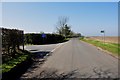
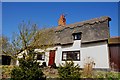
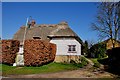
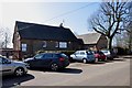
Photos of Reed
Area Information
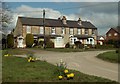
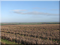
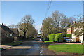
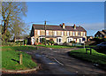
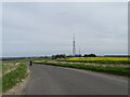
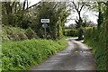
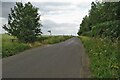
Reed is a compact built-up area in England, covering 32.9 hectares. It is a small but defined community, characterised by a mature demographic profile. The median age of residents is 70, suggesting a population skewed towards older adults. This is reflected in the area’s daily life, which likely prioritises convenience and accessibility over dynamic urban activity. Reed’s proximity to Royston Railway Station and nearby villages like Ashwell and Morden offers practical transport links. The area’s modest size means amenities are closely grouped, with five retail outlets within easy reach, including Tesco Priory and Morrisons Royston. For families, Reed First School provides a primary education option with a good Ofsted rating. While the broadband score is low at 34, mobile coverage is strong at 84, supporting remote work and connectivity. Reed is not a bustling hub but a place where simplicity and proximity to rural surroundings define the lifestyle. Homebuyers seeking a quiet, established community with essential services nearby may find Reed appealing, though its appeal is likely limited to those prioritising ease of access over urban vibrancy.
- Area Type
- Built Up Area 250
- Area Size
- 32.9 hectares
- Population
- Not available
- Population Density
- Not available
Reed’s lifestyle is shaped by its proximity to essential amenities. Five retail outlets, including Tesco Priory and Morrisons Royston, provide grocery and shopping options within practical reach. The area’s railway stations connect residents to nearby towns, offering access to broader leisure and cultural opportunities. While the data does not specify parks or recreational facilities, the presence of multiple retail and transport hubs suggests a focus on convenience over expansive green spaces. The community’s character is defined by its quiet, established nature, with services tailored to older residents. The availability of three railway stations enhances mobility, allowing residents to access larger centres for dining, entertainment, and healthcare. Overall, Reed offers a lifestyle prioritising accessibility and simplicity, though it may lack the diversity of amenities found in more densely populated areas.
Amenities
Schools
Reed First School is the primary educational institution within the area, offering a good Ofsted rating. This school serves the immediate community, providing a foundation for local children’s education. The absence of secondary schools in the data suggests that families may need to travel to nearby villages like Royston or Morden for further schooling. The single primary school option highlights the importance of proximity to larger towns for comprehensive education. For parents, Reed First School’s rating indicates a reliable standard of teaching, though the lack of additional schools may limit choices. The area’s demographic profile, with a high median age, may mean fewer children in the community, potentially affecting school dynamics. Overall, Reed’s educational landscape is basic but functional, requiring supplementary planning for families needing secondary education.
| Rank | School | Type | Entry gender | Ages |
|---|
Explore more schools in this area
Go to Schools tabDemographics
Reed’s population has a median age of 70, the highest in the dataset, indicating a community predominantly composed of older adults. The most common age range is listed as "Age: Total," which may suggest aggregated data rather than specific cohorts. Home ownership in the area is 69%, slightly below the national average, implying a mix of owner-occupied properties and rentals. The accommodation types and household composition data are not specified, but the high median age suggests a prevalence of single-person households or couples without children. The predominant ethnic group and religious composition are not detailed, but the data indicates no significant diversity metrics. This demographic profile may influence local services, with healthcare and leisure facilities tailored to older residents. The area’s low crime risk score of 80 further aligns with the characteristics of a mature, stable population. For buyers, this suggests a community with low turnover and a focus on long-term residency rather than transient populations.
Household Size
Accommodation Type
Tenure
Ethnic Group
Religion
Household Composition
Age
Household Deprivation
NS-SEC
Explore more demographic insights in this area
Go to Demographics tabPlanning
Planning Constraints
- Crime RiskPremium