Area Overview for Redbourn
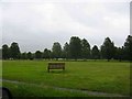
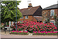
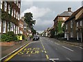
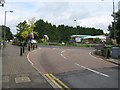
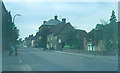
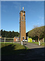
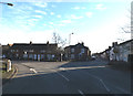
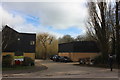
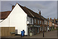
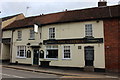
Photos of Redbourn


Area Information
Redbourn is a built-up area in Hertfordshire covering 1.5 km², functioning as a compact town within the wider commuter belt. Living in Redbourn means short distances to daily essentials, as the total land area concentrates shops, stations, and services within a tight radius. You are not in deep countryside nor a sprawling metropolis; the geography supports a focus on practicality. The layout centres around immediate access to major transport routes, making it a strategic choice for those requiring rapid connectivity to London or Luton. Daily life here relies on walking to local highs and lifts to regional hubs, rather than dependence on private vehicles for every journey. This density creates a community feel where journeys are frequent but brief. Prospective buyers looking for homes in Redbourn often value this efficiency, as the small footprint ensures that employment, education, and leisure facilities remain within practical reach. The area does not sprawl, meaning your essentials are never far away from your front door.
- Area Type
- Built Up Area 250
- Area Size
- 1.5 km²
- Population
- Not available
- Population Density
- Not available
Your daily routine in Redbourn benefits from immediate access to five retail outlets. You can shop at Co-op Redbourn, Sainsburys Woodhall, or Spar M6 within a short drive or walk. These venues provide for grocery and convenience needs without requiring lengthy journeys. Transport options are equally accessible, with five railway connections nearby. You can reach Harpenden Railway Station, St Albans Abbey Railway Station, or St Albans City Railway Station for broader travel networks. Two airports lie in close proximity, including London Luton Airport, which offers direct flight connections for business or leisure. This layout means you can handle local errands and explore the wider region without spending excessive time in a vehicle. The combination of local shops and major transport hubs creates a balanced lifestyle. Residents manage their week by combining local visits with regional travel efficiently.
Amenities
Schools
Families considering Redbourn have access to three specific educational institutions. Redbourn Primary School is a primary school holding an Ofsted rating of satisfactory. Redbourn Junior School operates as a primary institution without a listed Ofsted rating in the current data. St Luke's School functions as a special provision institution. This mix indicates that the area supports general primary education and broader needs for special educational requirements. If you are moving to Redbourn, you should verify specific catchment areas, as school planning can vary. The presence of a special school suggests the locality has capacity for diverse learning needs. Parents looking for schools near Redbourn must check individual admission policies for each facility. The satisfactory rating at the primary level is a baseline metric, while the junior school's status requires direct confirmation through local authority records.
| Rank | School | Type | Entry gender | Ages |
|---|
Explore more schools in this area
Go to Schools tabDemographics
The community character of Redbourn is defined by its mature population structure. The median age stands at 70, indicating a settlement dominated by older residents. This age profile suggests that the local estate is not transitioning into a youthful area but exists firmly as a retirement or established community. Household composition data supports this narrative, as the total count reveals a settlement accustomed to long-term residents rather than transient families. Home ownership levels sit at 76%, which is a significant majority. Most people who live in Redbourn own their homes outright with no mortgage burden. This high rate of ownership typically correlates with a lower turnover of properties compared to younger rental markets. While racial and religious demographics are listed in the source material without specific breakdowns, the stability of the population implies a consistent social fabric. The population's seniority means that the local pace of life often prioritises quiet and stability over the vibrancy associated with younger hubs.
Household Size
Accommodation Type
Tenure
Ethnic Group
Religion
Household Composition
Age
Household Deprivation
NS-SEC
Explore more demographic insights in this area
Go to Demographics tabPlanning
Planning Constraints
- Crime RiskPremium