Area Overview for Rayne
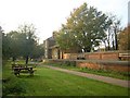
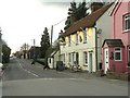
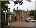
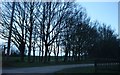
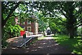
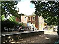
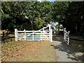
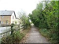
Photos of Rayne

Area Information
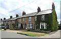
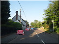
Rayne is a built-up area in England, covering 72.3 hectares. It is a compact, well-defined community with a median age of 70, suggesting a population skewed toward older residents. The area is predominantly owner-occupied, with 83% of homes owned by their occupants. Daily life here is shaped by its proximity to essential services, including a primary school with a good Ofsted rating, and a network of rail and bus connections. The broadband score of 100 indicates excellent internet connectivity, while mobile coverage is rated 83, which is good for most needs. Rayne’s low crime risk, with a safety score of 78, adds to its appeal as a secure place to live. The area’s character is defined by its practical amenities and established infrastructure, making it suitable for those seeking a stable, low-maintenance lifestyle. Nearby retail options and transport links further enhance its accessibility, though its smaller size means it is best suited for those who prefer a quieter, more contained environment.
- Area Type
- Built Up Area 250
- Area Size
- 72.3 hectares
- Population
- Not available
- Population Density
- Not available
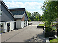
Rayne offers a practical mix of retail and transport amenities within easy reach. Five notable retail outlets include Chelmsford Star Co-operative Society Co, Lidl Braintree, and M&S Braintree BP, providing everyday shopping and convenience services. The area’s rail network includes four stations, such as Braintree and Cressing, while a bus interchange connects residents to local routes. These amenities contribute to a lifestyle that balances accessibility with a smaller, more contained environment. The absence of detailed information on parks or leisure facilities means that recreational opportunities may be limited to nearby areas. However, the presence of multiple retail and transport hubs ensures that daily errands and commuting are manageable without extensive travel. For those prioritising convenience over expansive leisure options, Rayne’s amenities are sufficient to support a straightforward, low-maintenance lifestyle.
Amenities
Schools
Rayne Primary and Nursery School is the only educational institution explicitly mentioned in the data. It is a primary school with an Ofsted rating of “good,” indicating a satisfactory standard of education. The absence of secondary schools or other educational facilities in the dataset suggests that families may need to look beyond Rayne for secondary schooling. However, the presence of a well-rated primary school is a key advantage for parents prioritising early education. The school’s rating implies that it meets national standards, though no further details on curriculum, staff, or student outcomes are provided. For families relying on local schools, Rayne’s primary institution offers a reliable foundation, but additional research would be necessary to assess the broader educational landscape in the surrounding area.
| Rank | School | Type | Entry gender | Ages |
|---|---|---|---|---|
| 1 | Rayne Primary and Nursery School | primary | N/A | N/A |
| 2 | Rayne Primary and Nursery School | primary | N/A | N/A |
Explore more schools in this area
Go to Schools tabDemographics
Rayne’s population has a median age of 70, the highest in the dataset, indicating a community dominated by older residents. The most common age range is listed as “Total,” which may reflect aggregated data rather than specific age brackets. Home ownership is high, with 83% of residents living in owner-occupied properties, suggesting a stable, long-term demographic. Accommodation types and household composition are not specified, but the overall profile points to a population that values security and familiarity. The area’s age profile may influence local services and amenities, with a focus on accessibility and healthcare. While no specific diversity metrics are provided, the data does not indicate significant deprivation, implying that quality of life is generally maintained. This demographic makeup suggests Rayne is a place for retirees or those in later life, with a strong emphasis on residential stability.
Household Size
Accommodation Type
Tenure
Ethnic Group
Religion
Household Composition
Age
Household Deprivation
NS-SEC
Explore more demographic insights in this area
Go to Demographics tabPlanning
Planning Constraints
- Crime RiskPremium