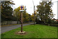
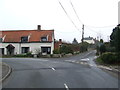
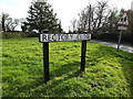
Area Overview for Raydon
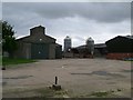
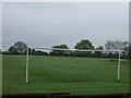
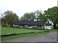
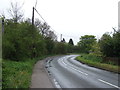
Photos of Raydon
Area Information
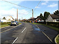
Raydon is a compact built-up area in England, covering 31.5 hectares. Its population, though not explicitly stated, is reflected in its demographics: the median age is 70, suggesting a community skewed toward older residents. This area is defined by its practical scale, with amenities and services clustered within walking or short driving distance. The presence of two railway stations—Manningtree and Mistley—connects Raydon to broader regional networks, while five retail outlets, including the East of England Co-operative Co, provide essential shopping options. Daily life here balances accessibility with a quieter, more subdued pace. The high home ownership rate of 80% indicates a stable residential base, with properties likely tailored to long-term occupancy rather than transient needs. For those considering living in Raydon, the combination of low crime risk, reliable digital connectivity, and proximity to transport links offers a foundation for a secure, functional lifestyle. The area’s character is shaped by its demographic profile and infrastructure, making it a viable choice for buyers prioritising safety, convenience, and simplicity.
- Area Type
- Built Up Area 250
- Area Size
- 31.5 hectares
- Population
- Not available
- Population Density
- Not available
Living in Raydon offers access to essential amenities within practical reach. The area includes five retail outlets, with the East of England Co-operative Co appearing three times, suggesting a focus on local shopping and community services. These stores likely provide everyday essentials, supporting a self-contained lifestyle. Two railway stations—Manningtree and Mistley—offer convenient connections to nearby towns and cities, enhancing accessibility for work, leisure, or travel. While the data does not mention parks or leisure facilities, the proximity to retail and transport implies a functional, if modest, lifestyle. Residents can expect a straightforward daily routine, with shopping and commuting options readily available. The absence of detailed information on recreational spaces means the area’s appeal to those seeking green spaces or cultural amenities remains unclear, but the existing infrastructure ensures practicality for everyday needs.
Amenities
Schools
| Rank | School | Type | Entry gender | Ages |
|---|
Explore more schools in this area
Go to Schools tabDemographics
Raydon’s population has a median age of 70, placing it well above the national average and suggesting a community dominated by older adults. The most common age range is listed as “Total,” which may reflect aggregated data but does not specify distribution across age groups. Home ownership is high at 80%, indicating a majority of residents live in properties they own, which often correlates with stability and long-term residency. The data does not specify household composition or accommodation types, but the 80% ownership rate implies a mix of owner-occupied homes, potentially including semi-detached or terraced properties typical of smaller towns. The absence of detailed information on ethnic diversity or religious composition means these aspects cannot be assessed, but the area’s age profile and ownership figures highlight a mature, settled population. For buyers, this suggests a community with established roots, though it may lack the dynamism of younger demographics.
Household Size
Accommodation Type
Tenure
Ethnic Group
Religion
Household Composition
Age
Household Deprivation
NS-SEC
Explore more demographic insights in this area
Go to Demographics tabPlanning
Planning Constraints
- Crime RiskPremium