Area Overview for Purdis Farm
Photos of Purdis Farm

Area Information
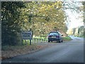
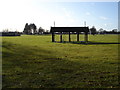
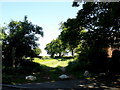
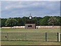
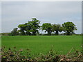
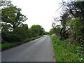
Purdis Farm is a civil parish located in the East Suffolk district of Suffolk, covering an area of 2.8 km². You will find this parish situated on the eastern outskirts of Ipswich, bordered by the neighbours of Ipswich, Foxhall, Nacton and Rushmere St Andrew. The location lies approximately 4¼ miles south-east of Ipswich town centre, offering a blend of suburban convenience and rural seclusion. The landscape encompasses the modern housing estate known as Warren Heath, the site formerly used as the Suffolk Agricultural Association Showground and now called Trinity Park, along with the grounds of Ipswich Golf Club and the natural expanse of Purdis Heath. Historically mentioned as an extra-parochial farm before becoming part of the Broke Hall Estate, the area was shaped significantly by land sales in the 1920s which established the golf club. Suburban housing development accelerated in the 1980s with projects by Tarmac Homes and McLeans. Today, residents enjoy access to the Sandlings Walk footpaths and Purdis Farm Lane, which lead through woods and heathland. This mix of residential density and protected green spaces defines daily life here, allowing you to escape the urban pace while remaining close to Ipswich and its amenities.
- Area Type
- Parish
- Area Size
- 2.8 km²
- Population
- Not available
- Population Density
- Not available
Demographics
The community profile in Purdis Farm is distinct due to its high median age of 70 years. This statistic indicates that the population consists largely of older residents, influencing the local culture and service needs. The data categorises the household composition and predominant ethnic group, religion, and accommodation types simply as totals, suggesting a homogenous and settled population structure typical of mature estates. With a home ownership rate standing at 82%, the vast majority of households in Purdis Farm occupy their residences outright rather than renting. This high level of ownership signals a stable neighbourhood where families likely stay for the long term. The demographic data does not specify particular breakdowns for age ranges beyond the median figure, but the score reinforces an area dominated by retirees. Safety is a significant factor for residents, with crime risk assessment showing a level classified as a pass and a safety score of 78 out of 100. This lower risk score indicates below-average crime rates compared to the wider region. The area is free from Ramsar wetland sites and protected nature reserves, though a portion falls within an Area of Outstanding Natural Beauty, contributing to its character without imposing strict planning constraints on individual gardens.
Household Size
Accommodation Type
Tenure
Ethnic Group
Religion
Household Composition
Age
Household Deprivation
NS-SEC
Explore more demographic insights in this area
Go to Demographics tabPlanning
Planning Constraints
- Flood RiskPremium
- Ramsar Wetland SitesPremium
- Area of Outstanding Natural BeautyPremium
- Protected Nature ReservePremium
- Protected WoodlandPremium
- Crime RiskPremium