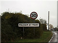
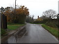
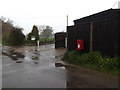
Area Overview for Pulham St Mary
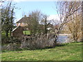
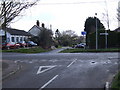
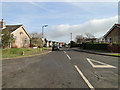
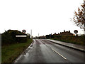
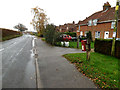
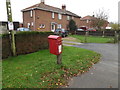
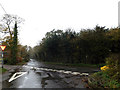
Photos of Pulham St Mary


Area Information
Living in Pulham St Mary offers a quiet, compact setting within England’s built-up areas. Covering 42.1 hectares, the area is small but functional, with a population skewed toward older residents, as the median age is 70. This suggests a community of long-term residents, many of whom may have lived in the area for decades. The presence of Diss Railway Station provides a practical link to nearby towns, while five retail outlets, including East of England Co-operative Co and Budgens Harleston, ensure basic shopping needs are met. The area’s safety score of 80/100 indicates a low crime risk, making it appealing for those prioritising security. With 70% of homes owner-occupied, Pulham St Mary feels like a stable, settled place. Daily life here is likely characterised by routine and familiarity, with limited but sufficient amenities. Its size and demographics suggest it is not a high-density urban area but a small, self-contained community where neighbours may know each other well. For buyers seeking a low-maintenance, secure location with practical access to transport and retail, Pulham St Mary could be a viable choice.
- Area Type
- Built Up Area 250
- Area Size
- 42.1 hectares
- Population
- Not available
- Population Density
- Not available
Residents of Pulham St Mary have access to five retail outlets within practical reach, including East of England Co-operative Co and Budgens Harleston. These shops provide essential services and convenience for daily shopping needs. The Diss Railway Station adds to the area’s connectivity, offering direct links to nearby destinations. While the data does not mention parks or leisure facilities, the presence of multiple retail options suggests a focus on practicality over expansive recreational spaces. The compact size of the area means amenities are closely clustered, reducing the need for long commutes. For those valuing convenience and proximity to basic services, the retail and transport options available in Pulham St Mary offer a functional lifestyle. The absence of detailed information on other amenities means the focus remains on the essentials, but the existing infrastructure supports a straightforward, low-maintenance daily routine.
Amenities
Schools
| Rank | School | Type | Entry gender | Ages |
|---|
Explore more schools in this area
Go to Schools tabDemographics
The population of Pulham St Mary has a median age of 70, indicating a community predominantly composed of older adults. This age profile suggests a demographic where retirement is the norm, and the area may cater to the needs of this group. Home ownership is high, with 70% of properties owned by their occupants, reflecting a stable, long-term resident base. The data does not specify household composition or diversity, but the 70% ownership rate implies a lower proportion of renters or transient populations. The accommodation types are not detailed, but the overall figure of 70% home ownership suggests a mix of housing stock, possibly including semi-detached or detached homes typical of smaller towns. The lack of specific data on ethnicity or religion means no conclusions can be drawn about the area’s cultural diversity. However, the age demographic and ownership figures together paint a picture of a mature, settled community with a focus on stability over rapid change.
Household Size
Accommodation Type
Tenure
Ethnic Group
Religion
Household Composition
Age
Household Deprivation
NS-SEC
Explore more demographic insights in this area
Go to Demographics tabPlanning
Planning Constraints
- Crime RiskPremium