Area Overview for Puckeridge and Standon
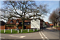
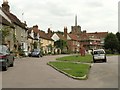
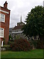
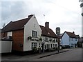
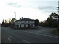
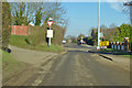
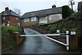
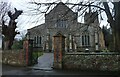
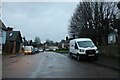
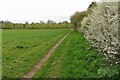
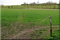
Photos of Puckeridge and Standon
Area Information
Puckeridge and Standon is a compact built-up area in England, spanning 1.1 km². Its population, while not explicitly stated, is reflected in its median age of 70, indicating a community skewed toward older residents. This area is characterised by a strong sense of stability, with 77% of homes owned by their occupants. Daily life here is shaped by proximity to essential services, including retail outlets and a rail connection to Ware station. The area’s small size means amenities are within practical reach, fostering a self-contained lifestyle. While it lacks the density of larger towns, its charm lies in its simplicity and accessibility. For those seeking a quieter, established neighbourhood with a focus on local convenience, Puckeridge and Standon offers a blend of practicality and community cohesion. The presence of multiple schools, including both primary and academy institutions, suggests a family-friendly orientation, though the mix of school types may appeal to different preferences.
- Area Type
- Built Up Area 250
- Area Size
- 1.1 km²
- Population
- Not available
- Population Density
- Not available
The lifestyle in Puckeridge and Standon is shaped by its proximity to essential amenities. Within practical reach are five retail outlets, including Spar, Co-op Buntingford, and Budgens Buntingford, offering everyday shopping needs. The nearest rail station, Ware, provides access to broader regional connectivity. While the area lacks large-scale leisure facilities, its compact nature ensures residents can access local shops and transport without long commutes. This balance of convenience and simplicity supports a low-maintenance lifestyle, ideal for those prioritising ease of access over extensive amenities.
Amenities
Schools
Puckeridge and Standon is served by several schools, including Roger De Clare First CofE School and St Thomas of Canterbury Catholic Primary School, both rated as good by Ofsted. Ralph Sadleir School, an academy, has a satisfactory rating. The area also includes Ralph Sadleir Middle School and St Thomas of Canterbury Roman Catholic Primary School, though the latter’s Ofsted rating is unspecified. The presence of both primary and academy schools offers families a range of educational choices, though the mix of ratings suggests variability in quality. Parents may need to assess individual school performance and proximity to their homes when considering the area.
| Rank | School | Type | Entry gender | Ages |
|---|
Explore more schools in this area
Go to Schools tabDemographics
The population of Puckeridge and Standon has a median age of 70, with the most common age range encompassing all age groups. This suggests a community with a significant proportion of older residents, though specific figures on household composition or diversity are not available. Home ownership is high, at 77%, indicating a stable residential base. The accommodation types present in the area are not specified, but the overall demographic profile points to a mature population. While no data on deprivation or ethnic diversity is provided, the high home ownership rate may correlate with lower turnover and a long-term resident base. For those considering the area, the demographic profile implies a quieter, less transient environment, which may align with preferences for a settled lifestyle.
Household Size
Accommodation Type
Tenure
Ethnic Group
Religion
Household Composition
Age
Household Deprivation
NS-SEC
Explore more demographic insights in this area
Go to Demographics tabPlanning
Planning Constraints
- Crime RiskPremium