Area Overview for Prittlewell Ward
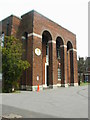
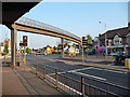
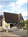
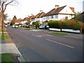
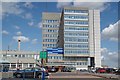
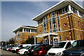
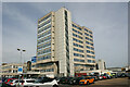
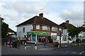
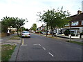
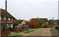
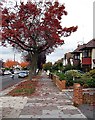
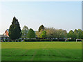
Photos of Prittlewell Ward
Area Information
Prittlewell Ward is a compact district within the larger borough of Southend-on-Sea in Essex. The area covers just 2.5 km², creating a dense and concentrated neighbourhood that forms part of the unitary authority. This ward is positioned to the north of Southend central, sharing the SS postcode area with surrounding communities. Its small size means that distances are short, making it a very walkable environment for daily activities. The northern boundary of Prittlewell Ward actually marks the limit of the borough itself, placing it near the edge of the administrative region. Residents here experience a distinct locality defined by these specific geographical constraints rather than sprawling expansion. Living in Prittlewell Ward offers a sense of settled locality due to the limited land area. The ward operates as a defined electoral unit with clear boundaries that shape local governance and community identity. You can navigate the whole area on foot, which reduces dependence on cars for many local trips. This physical compactness supports a tighter-knit feel compared to larger, more diffuse boroughs. The environment is characterised by established patterns of living rather than rapid development. Whether you are browsing homes in Prittlewell Ward or simply walking through the streets, the scale remains manageable and intimate. The area retains its residential footprint without the pressure of massive population shifts.
- Area Type
- District Borough Unitary Ward
- Area Size
- 2.5 km²
- Population
- Not available
- Population Density
- Not available
Demographics
The community profile of Prittlewell Ward is dominated by older residents. The median age for the population stands at 70 years, indicating an area where life expectancy and retirement are central themes. Most common age groups align with this high average, suggesting a mature demographic shift. With a home ownership rate of 69 per cent, the majority of households have purchased their properties outright or have significant equity built up over time. This high percentage of owner-occupiers points to a stable community where residents are likely to stay in their homes for decades. The area functions as a semi-rural settlement within the Southend-on-Sea borough, though specific household composition statistics are not detailed in the current records. You can expect a demographic makeup that reflects long-term settlement rather than transient housing. The population density within these 2.5 km² is significant, yet the nature of ownership suggests a quiet rather than chaotic atmosphere. Ethnically and religiously, the ward maintains its own distinct characteristics, though precise breakdowns are not currently available for this specific section of Southend-on-Sea. Living in Prittlewell Ward means engaging with a population that has likely rooted themselves deeply in the local landscape. The high ownership figure correlates with an area where families and individuals plan for the long term rather than short-term rentals. Schools near Prittlewell Ward will serve a community that values stability and continuity in education.
Household Size
Accommodation Type
Tenure
Ethnic Group
Religion
Household Composition
Age
Household Deprivation
NS-SEC
Explore more demographic insights in this area
Go to Demographics tabPlanning
Planning Constraints
- Flood RiskPremium
- Ramsar Wetland SitesPremium
- Area of Outstanding Natural BeautyPremium
- Protected Nature ReservePremium
- Protected WoodlandPremium
- Crime RiskPremium