Area Overview for Prettygate Ward
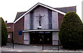
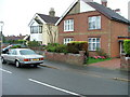
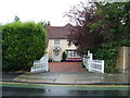
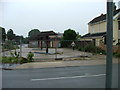
Photos of Prettygate Ward


Area Information
Prettygate Ward is a defined district borough unitary ward situated within the wider boundaries of Colchester in the county of Essex. This specific area covers a total land mass of 2.7 square kilometres and is centred geographically around the postcode CO3 4AQ. Historically, the ward was established by Colchester Borough Council in preparation for the elections held on 6th May 1976. Before this formal creation, the location was administered as part of the larger Lexden and Winstree wards. Today, the community has grown to encompass a population of approximately 1,706 residents. Living in Prettygate Ward means residing in an established urban neighbourhood that serves as an integral part of Colchester's local fabric. The area stands as a distinct administrative unit within the borough, offering a settled environment for its permanent inhabitants. Residents benefit from a long-standing local governance structure that has remained in place for nearly five decades. The ward represents a stable, permanent settlement rather than a transient housing estate. Its identity as a separate ward was cemented during the mid-1970s, creating a distinct sense of place within the broader Colchester district. ### The community profile within Prettygate Ward reflects a settled population with an average median age of 70 years. This demographic characteristic defines a neighbourhood predominantly occupied by older adults rather than families with young children or young professionals. With eight out of every ten residents owning their home outright, the area displays a very high retention rate of permanent homeownership. This figure stands at 81%, indicating that the vast majority of households are free from rental obligations. The remaining 19% of homes are likely occupied by landlords or those in the process of purchasing. Household composition in the ward aligns with an ageing population, where total numbers reflect a community built over generations rather than a fast-moving demographic. The accommodation stock supports long-term residents who have chosen to stay put rather than move frequently. Diversity metrics are not explicitly detailed in the current dataset, so observations rely strictly on the age and ownership data available. The social fabric appears stable, characterised by long-term tenants and centuries-old property owners who have taken root in this specific local landscape. ### The property market in Prettygate Ward is defined by its overwhelmingly owner-occupied nature. Eighty-one percent of all residential units within the ward are owned by their occupants, with only a small fraction of the stock available within the private rental market. This high level of homeownership suggests that the area attracts buyers looking for stability and permanence rather than short-term renting. The total accommodation type data confirms that the ward is a mature housing market where the majority of transactions involve existing owners or new buyers stepping into a cycle of continued ownership. Homes in Prettygate Ward are viewed as a legacy asset rather than a temporary stopgap. The housing stock likely consists of established properties that have survived the ward's history since its separation from the Lexden and Winstree wards in 1976. For a prospective buyer, the market here offers the opportunity to join a community where most neighbours have deep local roots. The scarcity of rental properties implies that price competition may be higher among buyers but lower among landlords seeking tenants. ### Digital connectivity in Prettygate Ward is extremely robust, supporting seamless working from home and heavy internet usage. The fixed broadband quality score for the area registers at 95 out of 100. This rating places the ward among the top percentile for internet speeds and reliability across England. Residents can expect minimal interruption to video calls, cloud storage, or streaming services regardless of the time of day. Such connectivity levels are ideal for remote workers, students, and anyone who relies on high-bandwidth applications for daily tasks. The infrastructure supports modern digital lifestyles without the buffer lags common in older or rural estates. Mobile coverage and other connectivity metrics are not detailed in the current data, but the broadband figure alone indicates a technically advanced environment. For those commuting into Colchester or London, the high-speed internet serves as a crucial lifeline between the home office and the rest of the world. Living in this area guarantees that digital demands are met instantly and efficiently. ### Environmental and safety assessments for Prettygate Ward reveal a neighbourhood with minimal planning constraints and low physical risks. The area registers zero risk scores for flooding, meaning there is no designated low flood risk coverage within the boundaries of the ward. Similarly, the land is free from Ramsar wetland sites and contains no designated Areas of Outstanding Natural Beauty. There are also no protected nature reserves or protected woodlands overlaying the residential zones. This absence of planning constraints simplifies construction and development for future projects while ensuring residents do not live next to environmentally restricted zones. In terms of personal safety, the crime risk assessment provides a score of 74 out of 100. This figure indicates a below-average crime rate relative to national standards. The low crime risk level suggests that the ward is a relatively safe place to live, park a car, or walk at night. Residents can expect a secure environment where the primary environmental concerns relate to historical property issues rather than modern safety threats. ### Who typically lives in Prettygate Ward? The community profile shows a median age of 70, indicating an older population. Eighty-one percent of residents own their homes outright, suggesting a stable community of long-term dwellers. The ward comprises approximately 1,706 people spread across 2.7 square kilometres. This demographic data points to a settled area rather than one with a high influx of young families or students. How is the broadband and connectivity in Prettygate Ward? Digital infrastructure is excellent for residents, with a fixed broadband quality score of 95 out of 100. This rating guarantees high-speed internet suitable for remote working and heavy streaming. The connection quality is sufficient to support multiple devices and heavy data usage without notable lag or disruption. Is Prettygate Ward a safe place to live? Yes, the ward scores low on risk assessments. It has zero flood risk and no protected woodland or wetland constraints. The crime risk score is 74 out of 100, which places it below the national average for crime rates. Residents benefit from a secure environment with minimal environmental hazards.
- Area Type
- District Borough Unitary Ward
- Area Size
- 2.7 km²
- Population
- Not available
- Population Density
- Not available
Demographics
The community profile within Prettygate Ward reflects a settled population with an average median age of 70 years. This demographic characteristic defines a neighbourhood predominantly occupied by older adults rather than families with young children or young professionals. With eight out of every ten residents owning their home outright, the area displays a very high retention rate of permanent homeownership. This figure stands at 81%, indicating that the vast majority of households are free from rental obligations. The remaining 19% of homes are likely occupied by landlords or those in the process of purchasing. Household composition in the ward aligns with an ageing population, where total numbers reflect a community built over generations rather than a fast-moving demographic. The accommodation stock supports long-term residents who have chosen to stay put rather than move frequently. Diversity metrics are not explicitly detailed in the current dataset, so observations rely strictly on the age and ownership data available. The social fabric appears stable, characterised by long-term tenants and centuries-old property owners who have taken root in this specific local landscape. ### The property market in Prettygate Ward is defined by its overwhelmingly owner-occupied nature. Eighty-one percent of all residential units within the ward are owned by their occupants, with only a small fraction of the stock available within the private rental market. This high level of homeownership suggests that the area attracts buyers looking for stability and permanence rather than short-term renting. The total accommodation type data confirms that the ward is a mature housing market where the majority of transactions involve existing owners or new buyers stepping into a cycle of continued ownership. Homes in Prettygate Ward are viewed as a legacy asset rather than a temporary stopgap. The housing stock likely consists of established properties that have survived the ward's history since its separation from the Lexden and Winstree wards in 1976. For a prospective buyer, the market here offers the opportunity to join a community where most neighbours have deep local roots. The scarcity of rental properties implies that price competition may be higher among buyers but lower among landlords seeking tenants. ### Digital connectivity in Prettygate Ward is extremely robust, supporting seamless working from home and heavy internet usage. The fixed broadband quality score for the area registers at 95 out of 100. This rating places the ward among the top percentile for internet speeds and reliability across England. Residents can expect minimal interruption to video calls, cloud storage, or streaming services regardless of the time of day. Such connectivity levels are ideal for remote workers, students, and anyone who relies on high-bandwidth applications for daily tasks. The infrastructure supports modern digital lifestyles without the buffer lags common in older or rural estates. Mobile coverage and other connectivity metrics are not detailed in the current data, but the broadband figure alone indicates a technically advanced environment. For those commuting into Colchester or London, the high-speed internet serves as a crucial lifeline between the home office and the rest of the world. Living in this area guarantees that digital demands are met instantly and efficiently. ### Environmental and safety assessments for Prettygate Ward reveal a neighbourhood with minimal planning constraints and low physical risks. The area registers zero risk scores for flooding, meaning there is no designated low flood risk coverage within the boundaries of the ward. Similarly, the land is free from Ramsar wetland sites and contains no designated Areas of Outstanding Natural Beauty. There are also no protected nature reserves or protected woodlands overlaying the residential zones. This absence of planning constraints simplifies construction and development for future projects while ensuring residents do not live next to environmentally restricted zones. In terms of personal safety, the crime risk assessment provides a score of 74 out of 100. This figure indicates a below-average crime rate relative to national standards. The low crime risk level suggests that the ward is a relatively safe place to live, park a car, or walk at night. Residents can expect a secure environment where the primary environmental concerns relate to historical property issues rather than modern safety threats. ### Who typically lives in Prettygate Ward? The community profile shows a median age of 70, indicating an older population. Eighty-one percent of residents own their homes outright, suggesting a stable community of long-term dwellers. The ward comprises approximately 1,706 people spread across 2.7 square kilometres. This demographic data points to a settled area rather than one with a high influx of young families or students. How is the broadband and connectivity in Prettygate Ward? Digital infrastructure is excellent for residents, with a fixed broadband quality score of 95 out of 100. This rating guarantees high-speed internet suitable for remote working and heavy streaming. The connection quality is sufficient to support multiple devices and heavy data usage without notable lag or disruption. Is Prettygate Ward a safe place to live? Yes, the ward scores low on risk assessments. It has zero flood risk and no protected woodland or wetland constraints. The crime risk score is 74 out of 100, which places it below the national average for crime rates. Residents benefit from a secure environment with minimal environmental hazards.
Household Size
Accommodation Type
Tenure
Ethnic Group
Religion
Household Composition
Age
Household Deprivation
NS-SEC
Explore more demographic insights in this area
Go to Demographics tabPlanning
Planning Constraints
- Flood RiskPremium
- Ramsar Wetland SitesPremium
- Area of Outstanding Natural BeautyPremium
- Protected Nature ReservePremium
- Protected WoodlandPremium