Area Overview for Potters Bar Oakmere Ward
Photos of Potters Bar Oakmere Ward


Area Information
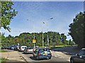
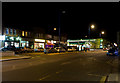
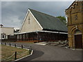
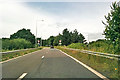
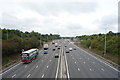
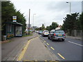
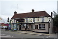
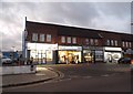
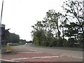
Living in Potters Bar Oakmere Ward offers a settled suburban experience typical of the Green Belt commuter belt. This electoral ward sits within the town of Potters Bar in Hertfordshire, approximately 13 miles north of central London. The area covers 2.6 square kilometres and is centred near Oakmere Park and the High Street (A1000). Residents enjoy immediate access to local features including lakes, footpaths, and fitness stations within the parkland. High Street serves as a key commercial spine, while streets like Oakmere Lane, Ashwood Road, and Darkes Lane form the residential fabric. The community has deep historical roots, dating back to the early 13th century as a settlement on the former Great North Road. Significant local landmarks include Oakmere House and the Admiral Byng pub, which commemorates a bygone era. Daily life balances quiet residential streets with proximity to amenities like The Old Manor and shops on Darkes Lane. The ward has retained its character despite urban growth, offering a mix of housing on roads such as Barr Road and Wyllyotts Place. Prospective buyers appreciate the connectivity to Potters Bar station and the surrounding Green Belt.
- Area Type
- District Borough Unitary Ward
- Area Size
- 2.6 km²
- Population
- Not available
- Population Density
- Not available
Demographics
The community in Potters Bar Oakmere Ward reflects the broader profile of the area, with a distinct age structure influencing household dynamics. The median age for residents is 70, indicating a population skewed towards older demographics. This statistical profile suggests a quarter of the population consists of those aged 65 and over. Households in the ward are diverse, contributing to the overall composition of the town's 22,536 residents across all wards in 2021. A significant portion of this population identifies with the predominant ethnic group for the total area, maintaining the existing cultural fabric. Religious composition mirrors the total ward figures, reflecting standard regional patterns. Social stability is highlighted by high home ownership levels, with 65% of residents owning their property outright or with a mortgage. This contrasts sharply with rented sectors, meaning most families prioritize long-term security. While specific deprivation indices are not provided in available records, positive housing tenure rates generally correlate with stable, owner-occupied neighbourhoods. The lack of data on minority groups or detailed deprivation metrics means聚焦ing on the clear trend of an older, predominantly owner-occupied community living in the ward.
Household Size
Accommodation Type
Tenure
Ethnic Group
Religion
Household Composition
Age
Household Deprivation
NS-SEC
Explore more demographic insights in this area
Go to Demographics tabPlanning
Planning Constraints
- Flood RiskPremium
- Ramsar Wetland SitesPremium
- Area of Outstanding Natural BeautyPremium
- Protected Nature ReservePremium
- Protected WoodlandPremium
- Crime RiskPremium