Area Overview for Potten End
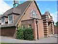
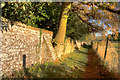
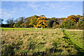
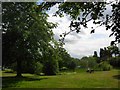
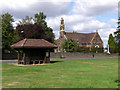
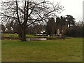
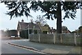
Photos of Potten End


Area Information
Potten End, a built-up area in England spanning 89 hectares, offers a distinct blend of residential living with a focus on community and accessibility. With a median age of 70, the area is home to a predominantly older population, reflecting a mature demographic profile. Daily life here is shaped by its proximity to key amenities, including multiple railway stations and a mix of retail and educational facilities. The high home ownership rate of 74% suggests a stable, long-term resident base, with many properties likely to be family-owned or occupied by retirees. While the area is small, its strategic location near Berkhamsted and Hemel Hempstead ensures easy access to larger towns and services. For those considering living in Potten End, the combination of safety, practical connectivity, and a well-established community makes it an appealing choice for those seeking a quieter, settled lifestyle.
- Area Type
- Built Up Area 250
- Area Size
- 89.0 hectares
- Population
- Not available
- Population Density
- Not available
Living in Potten End offers access to a range of amenities within practical reach. Retail options include Asda Hall, Tesco Warners, and Asda Dacorum, providing essential shopping for groceries and daily needs. The area’s rail network, with stations at Berkhamsted, Hemel Hempstead, and Apsley, ensures convenient travel to larger towns and cities. Chesham Underground Station adds another layer of connectivity, particularly for those using the London Underground. While parks and leisure facilities are not specified in the data, the presence of multiple retail and transport hubs suggests a lifestyle focused on convenience and accessibility. The mix of shopping, transport, and nearby schools creates a functional environment for residents seeking a balanced daily routine.
Amenities
Schools
Residents of Potten End have access to two notable educational institutions. Potten End CofE Primary School provides a state-funded primary education with a good Ofsted rating, ensuring a reliable foundation for younger children. Nearby, Haresfoot Senior School offers an independent education option, catering to families seeking alternative schooling. The coexistence of state and independent schools provides flexibility for parents, whether they prioritise affordability or specific curricular approaches. While no data on school performance beyond Ofsted ratings is provided, the presence of both school types suggests a range of educational choices. For families, this diversity may be a key consideration when evaluating the area’s suitability for raising children.
| Rank | A + A* % | School | Type | Entry gender | Ages |
|---|---|---|---|---|---|
| 1 | N/A | Potten End CofE Primary School | primary | N/A | N/A |
| 2 | N/A | Haresfoot Senior School | independent | N/A | N/A |
Explore more schools in this area
Go to Schools tabDemographics
Potten End’s population is defined by its median age of 70, indicating a community largely composed of older residents. This age profile suggests a demographic skewed towards retirees or long-term residents, with fewer younger families. The home ownership rate of 74% is notably high, reflecting a population that values stability and long-term investment in property. While specific data on household composition and accommodation types is not provided, the overall figures suggest a community with a strong sense of continuity. The absence of detailed diversity metrics means the area’s ethnic and cultural composition remains less defined in the data. For those considering relocation, the demographic profile highlights a mature, low-turnover environment, which may appeal to buyers seeking a quiet, established neighbourhood.
Household Size
Accommodation Type
Tenure
Ethnic Group
Religion
Household Composition
Age
Household Deprivation
NS-SEC
Explore more demographic insights in this area
Go to Demographics tabPlanning
Planning Constraints
- Crime RiskLocked